(2/26 – 3/2/2026)
There was heavy rain in California in February, and we heard that wildflowers had already started blooming. Therefore, Rei and I decided to take a quick road trip to Southern California. We would also visit Channel Islands National Park, the only remaining national park in California we haven’t visited.
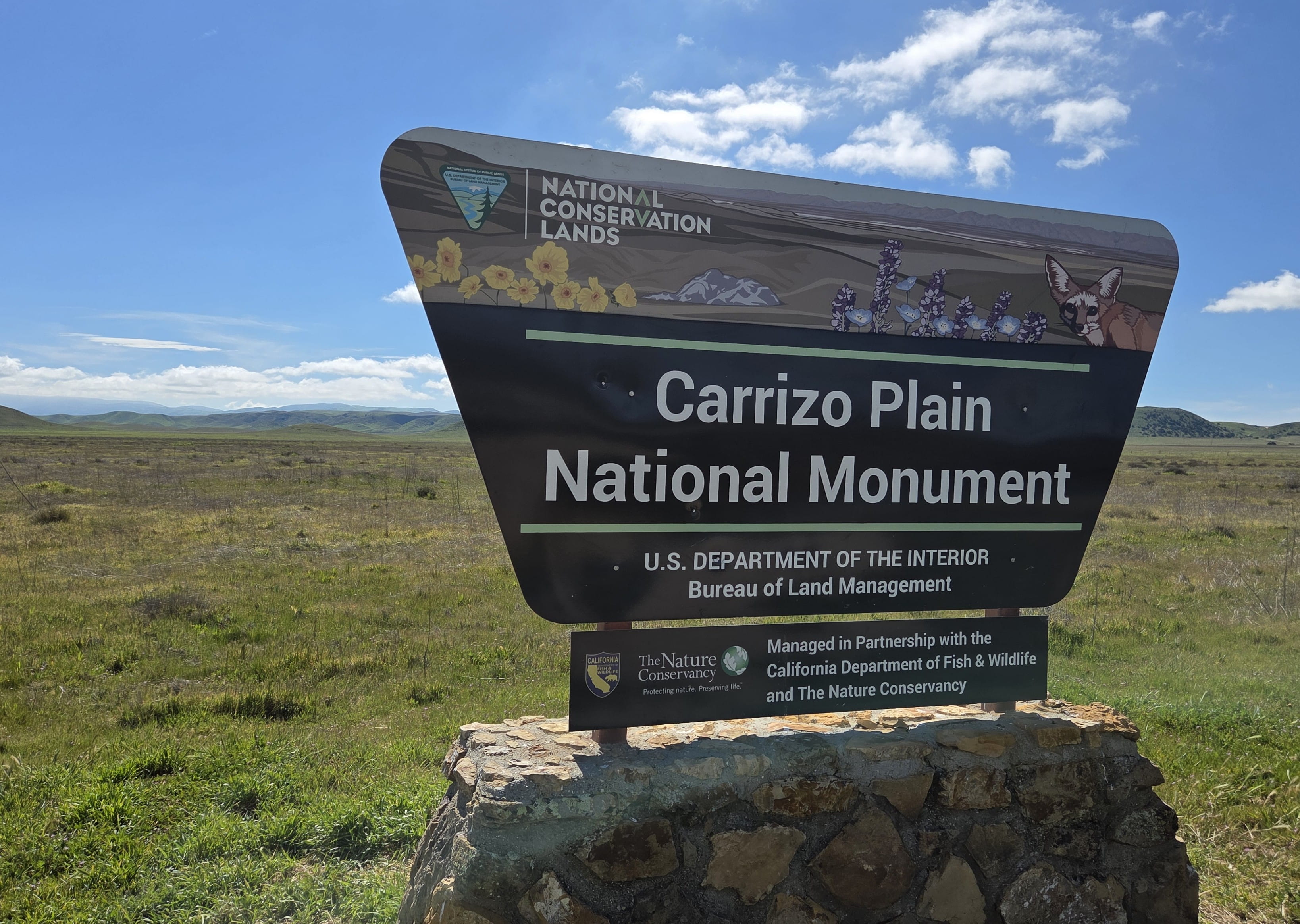
Day 1: Carrizo Plain National Monument
We loaded the car and left the house around 7am to reach Carrizo Plain National Monument. It was very foggy this morning.
Soon we could see lots of yellow flowers carpeting the hillsides. It’s a promising sign that California wildflower season indeed had started.
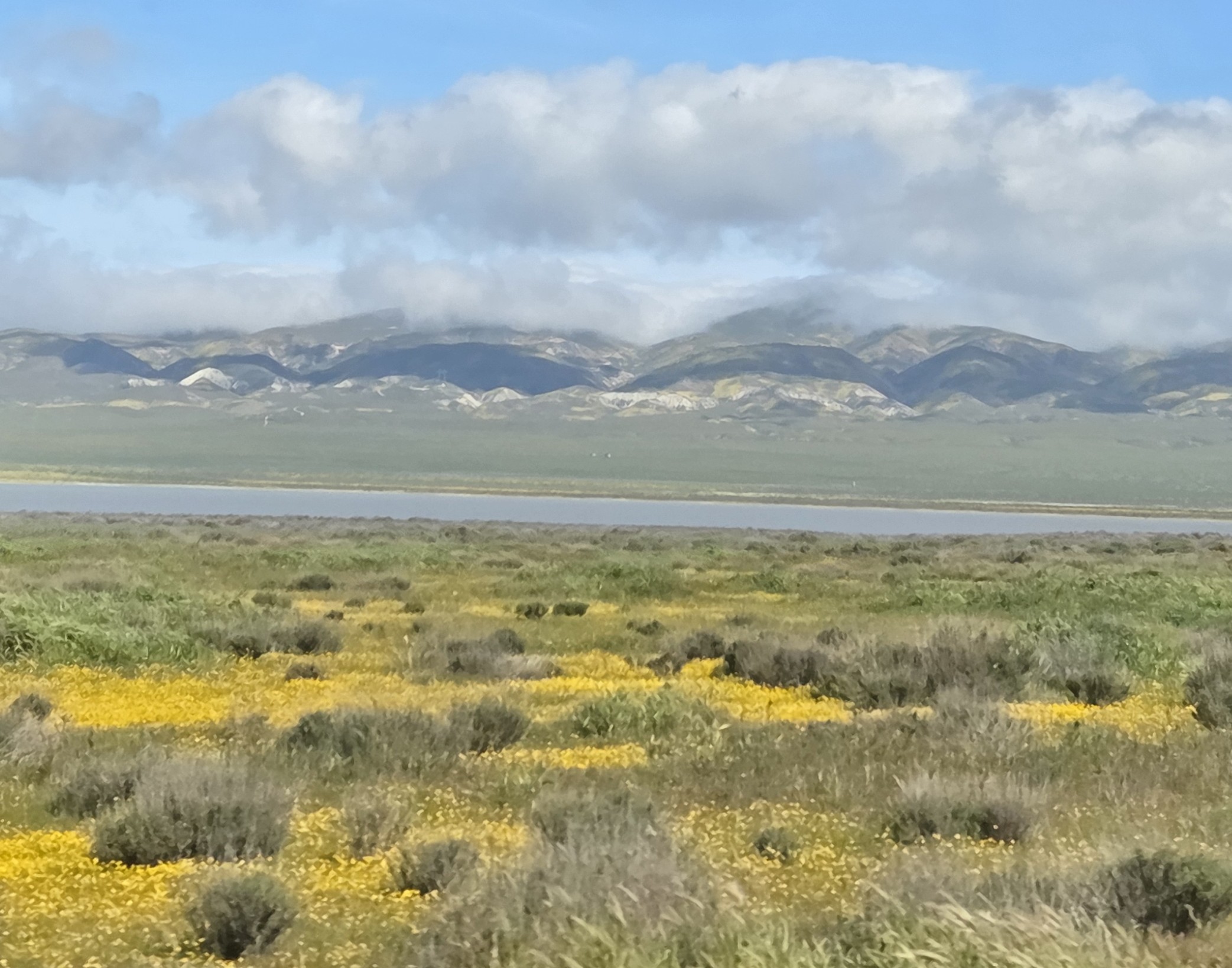
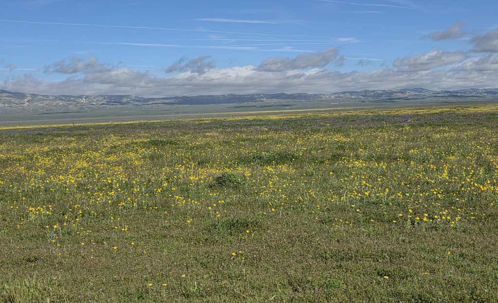
The drive to reach Carrizo Plain was very long but very scenic too. We drove past Soda Lake; there were a lot of yellow wildflowers along the lake shore. When we arrived at the visitor center, it was already noontime. The weather was very sunny.
Several visitors were already inside the visitor center, asking about where to see the wildflowers. The ranger was very friendly and helpful. He told us that there were various wildflowers blooming, but the full bloom wouldn’t happen until mid-March to April.
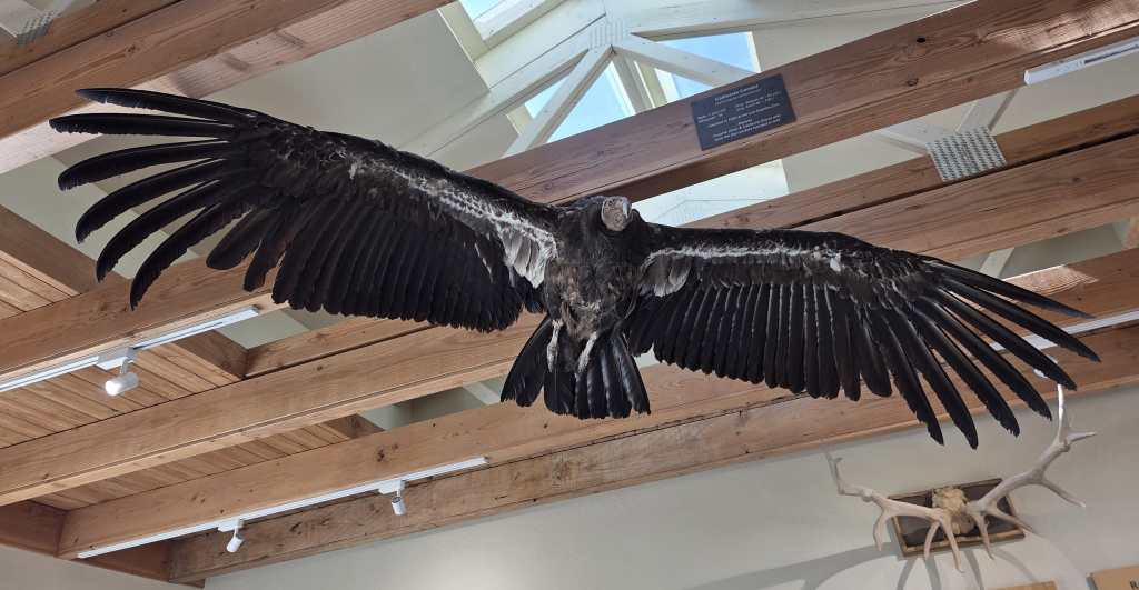
The small visitor center had information regarding animals and plants in the region. There was also a California Condor taxidermy hanging from the ceiling. We got our stamps too, which was Rei’s main concern.
There were several picnic tables around the parking lot outside of the visitor center. Many people were having lunch. Rei and I also had our packed lunch (Greek pasta salad brought from home) there before the exploration.
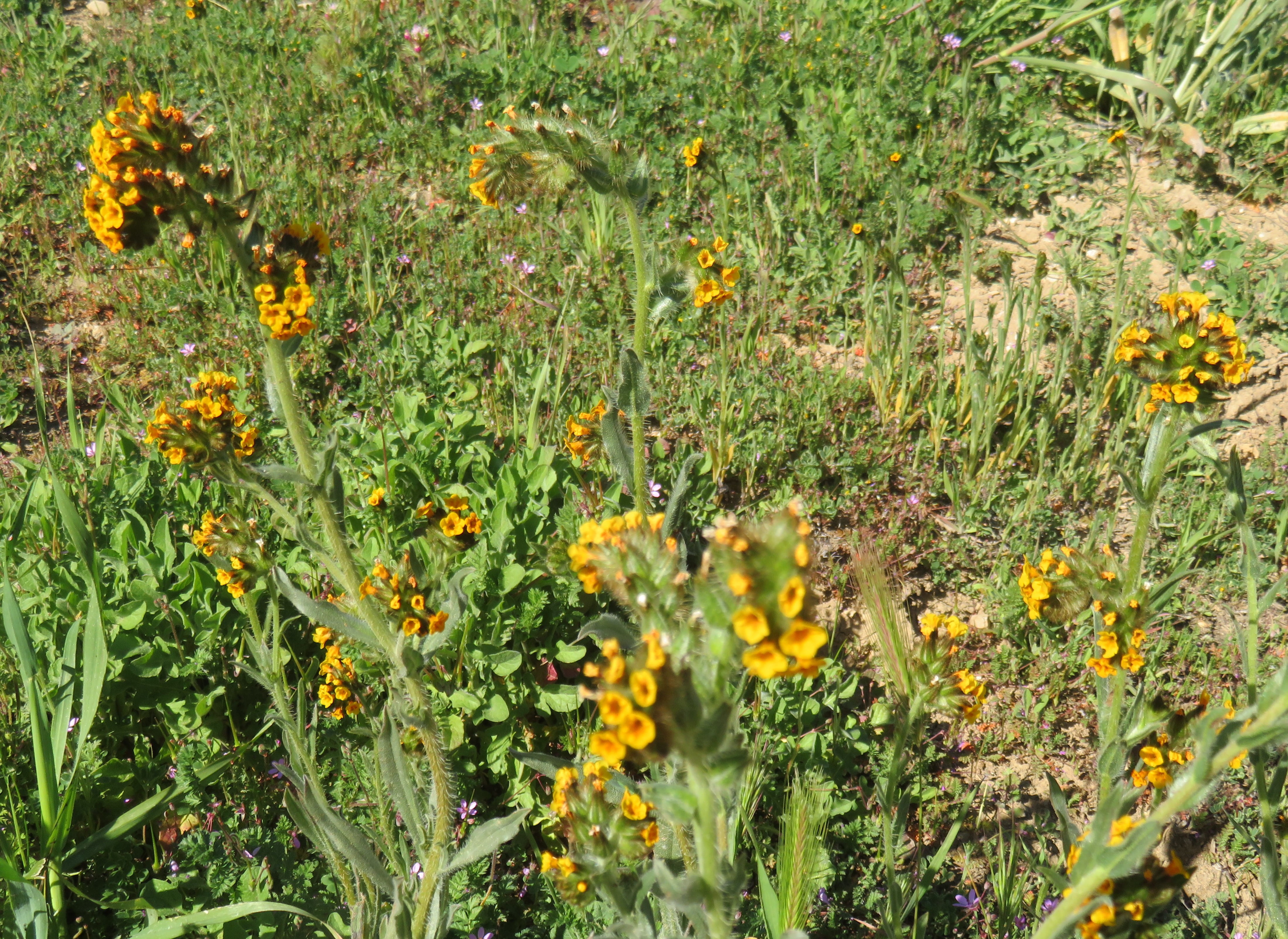
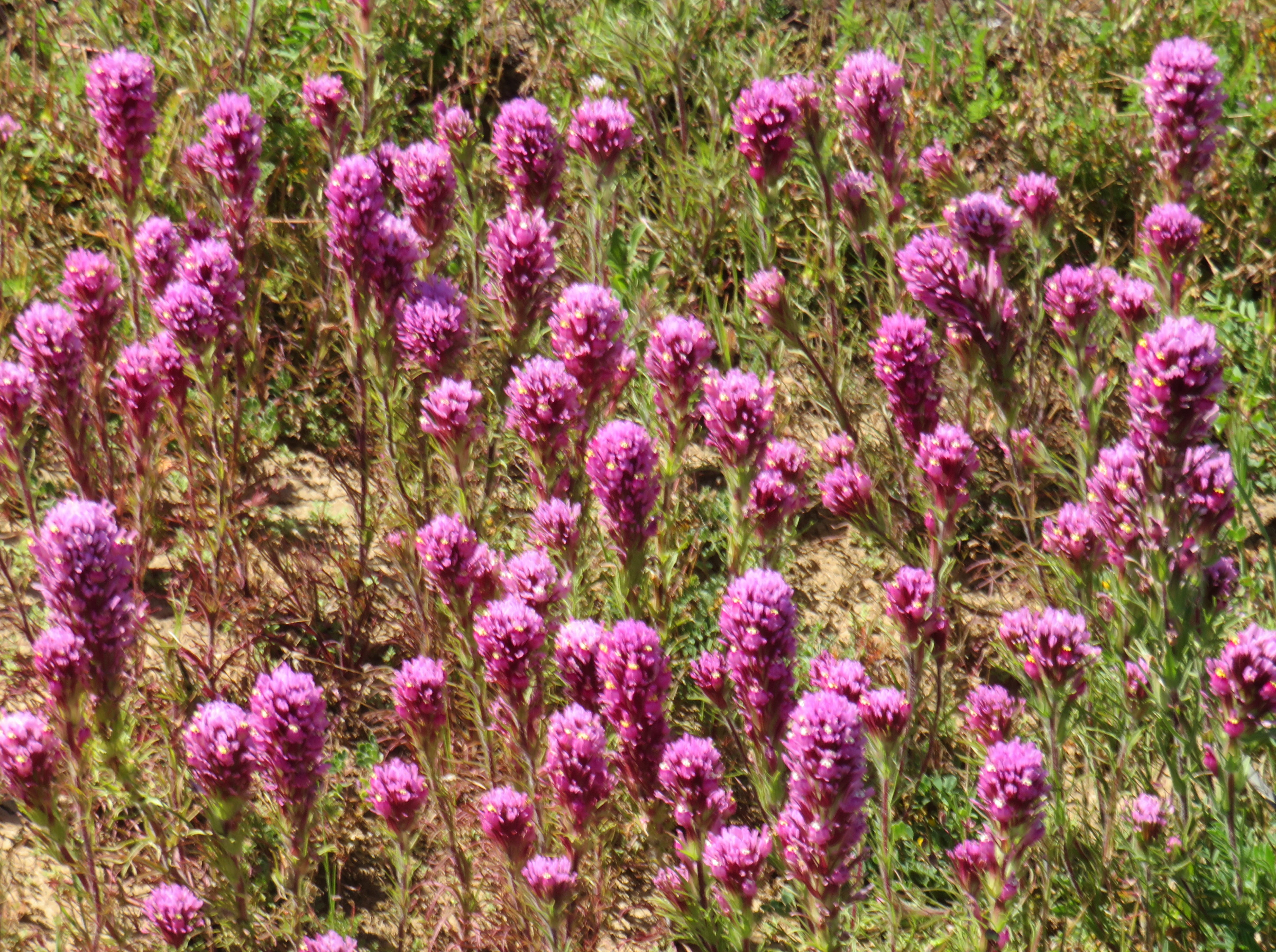
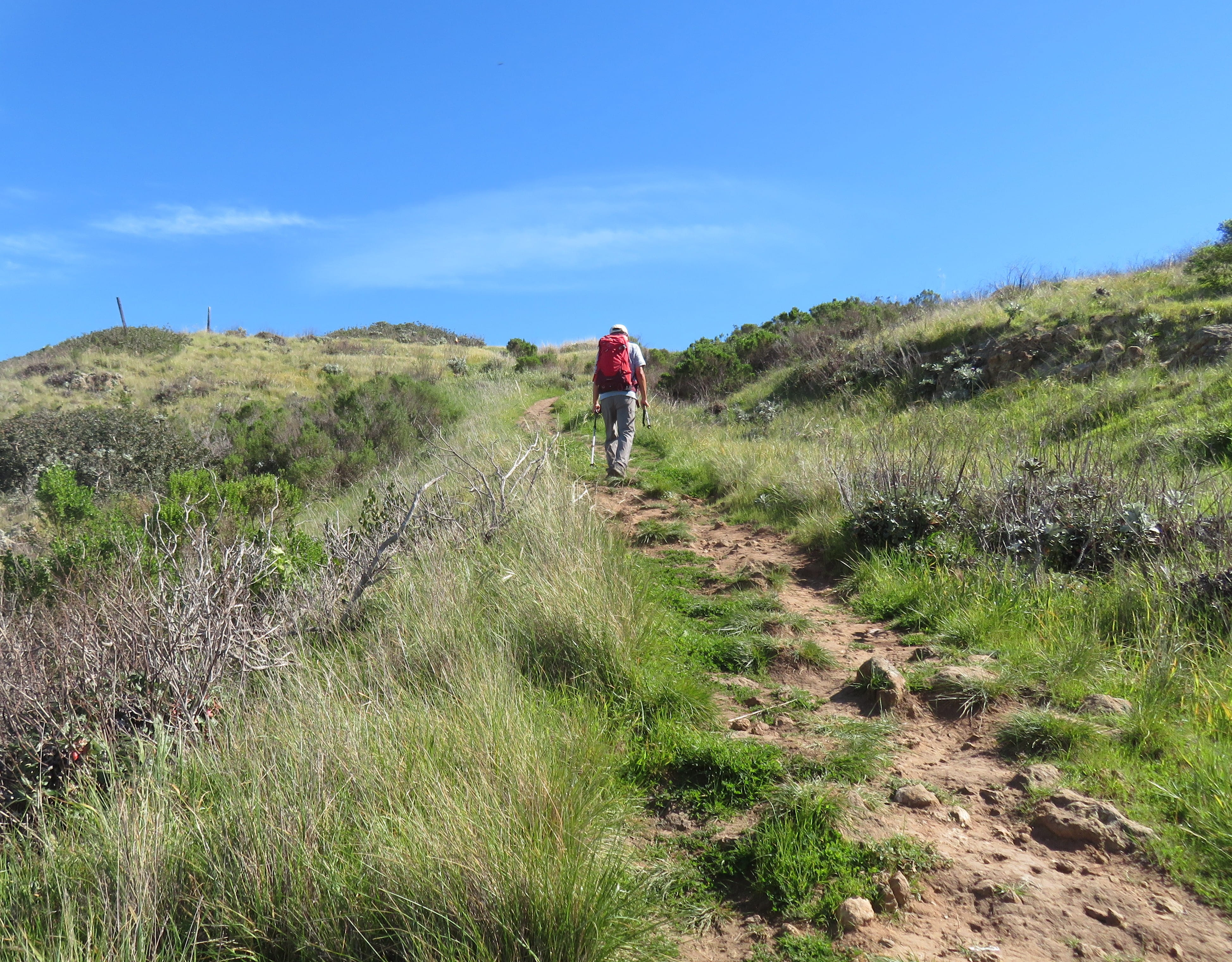
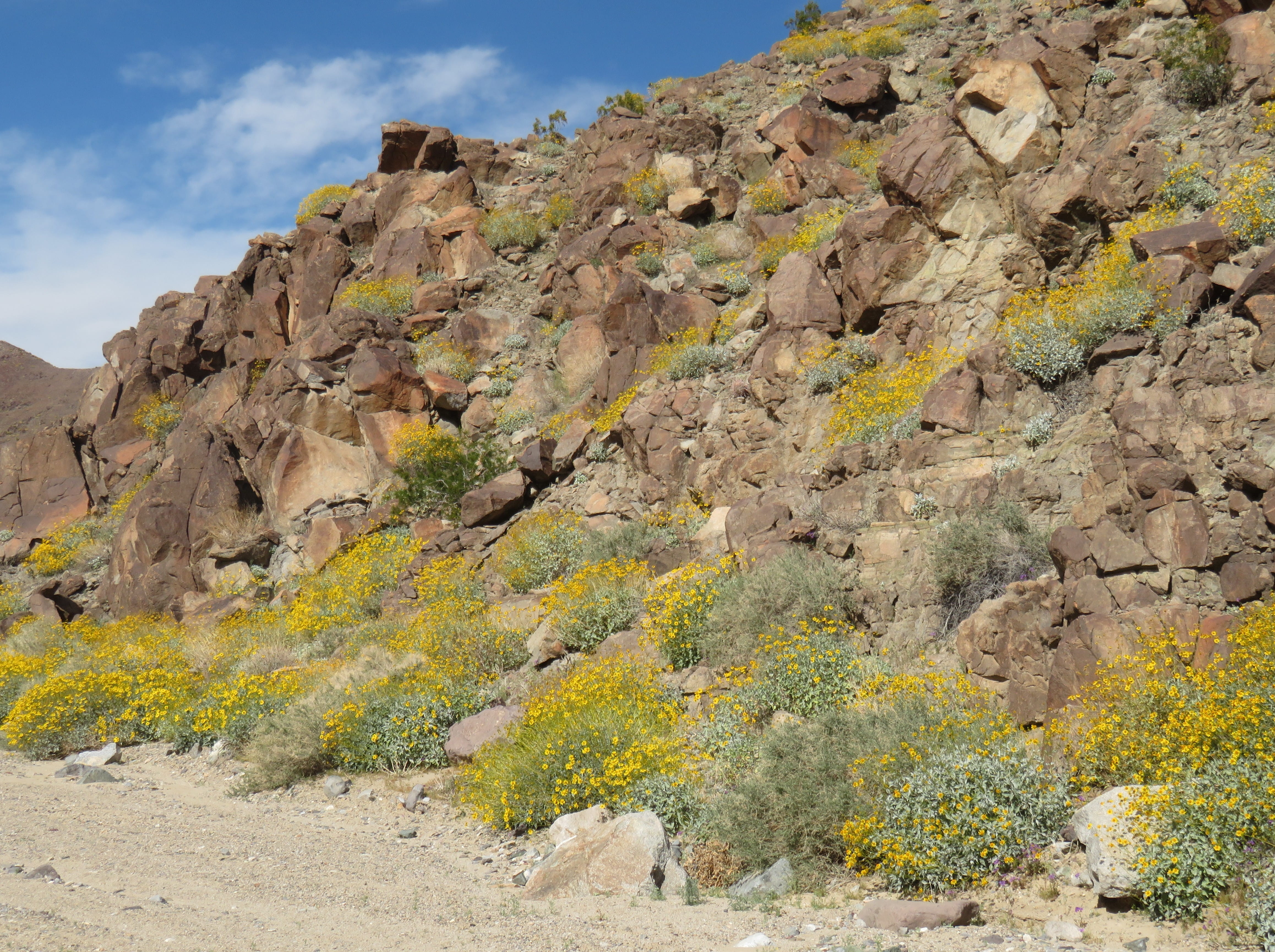
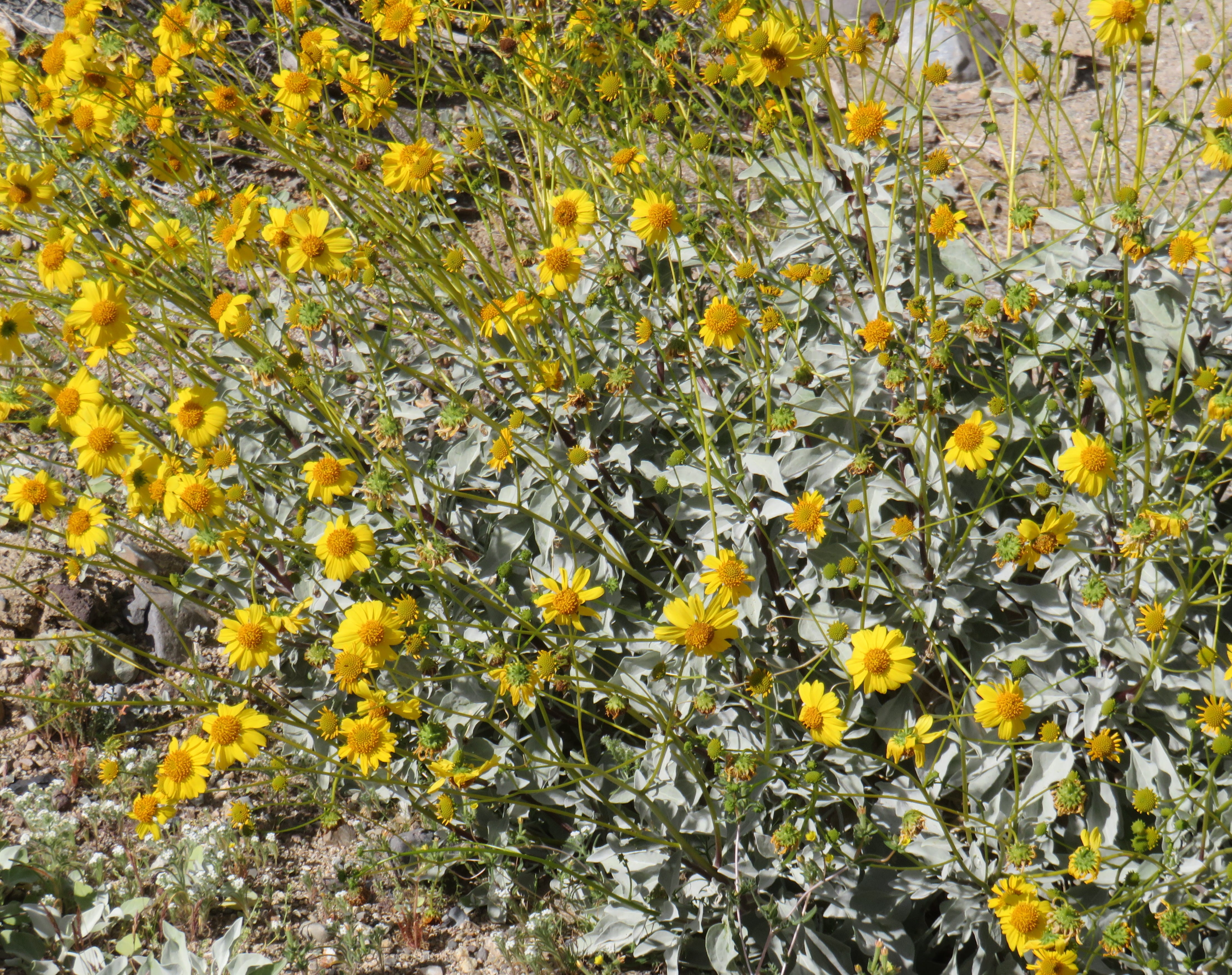
The ranger suggested we drive to Selby Campground and then hike about one mile to view wildflowers. When we arrived at the trailhead, I could see many yellow Fiddleneck and purple Owl’s Clover flowers blooming. The surrounding hillsides were dotted with many yellow flowers.

We climbed a small hill to the top. The hilltop viewpoint provided a spectacular view of the nearby Soda Lake and colorful hills. Rei suggested that we return in a month or so, and hopefully there will be a superbloom!
Afterwards, we walked back to the car to drive to Venture. It was again a long and twisty drive. However, the scenic views along the way were truly amazing! We stopped the car many times to take more photos. We could see other cars also stopped by the roadside with drivers taking pictures.
We reached our hotel in Ventura around 5pm. Last night I packed all the leftover food in the refrigerator into small containers stored in an ice chest. So, we had leftover chicken yakisoba for dinner tonight.
Day 2: Channel Islands National Park
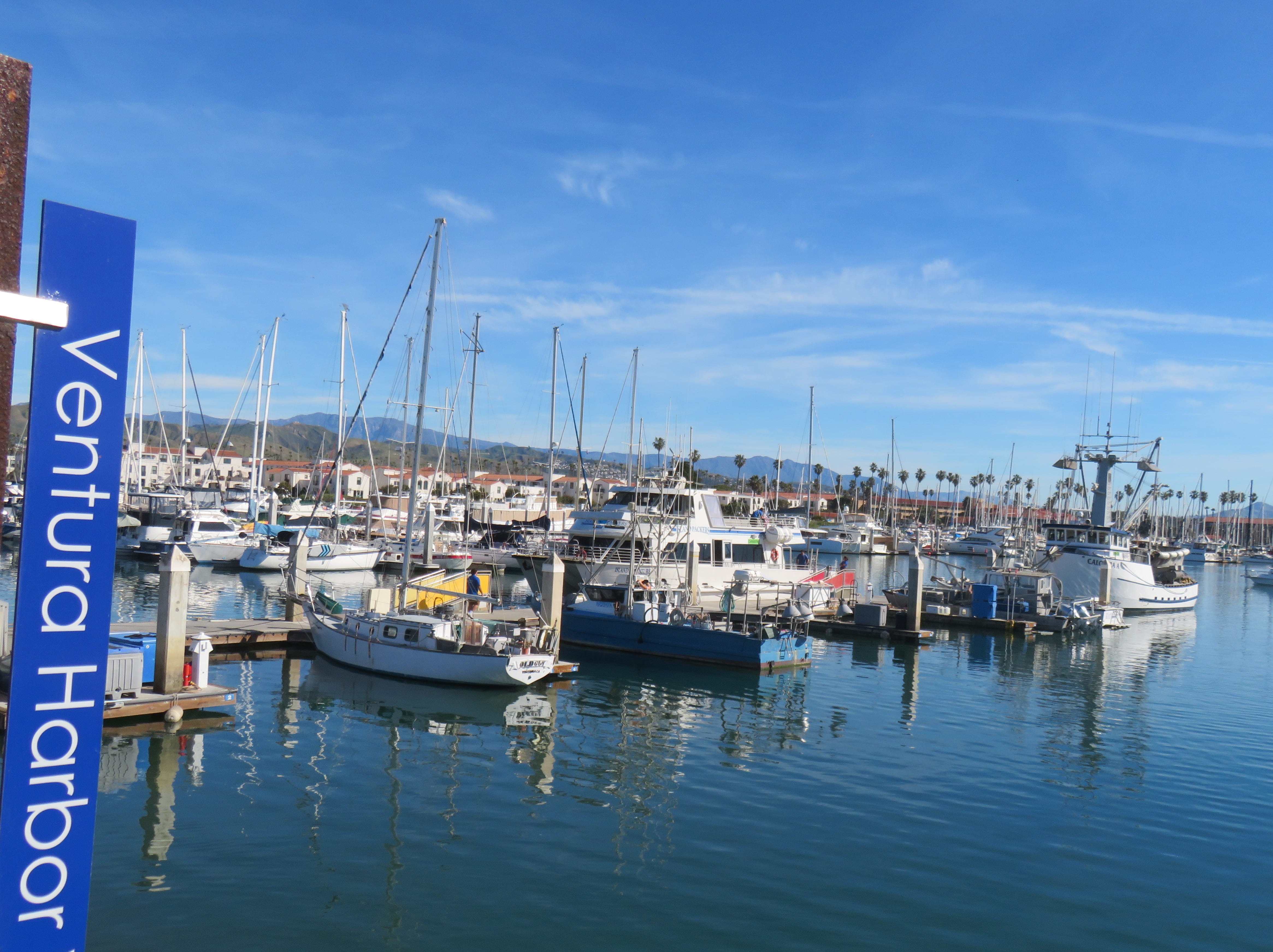
Our hotel was very close to the Channel Islands National Park visitor center in Ventura. When we arrived there, the visitor center was not open yet. Rei wanted me to take a photo of him in front of the visitor center. A very friendly ranger approached us and offered to take photos of both of us!
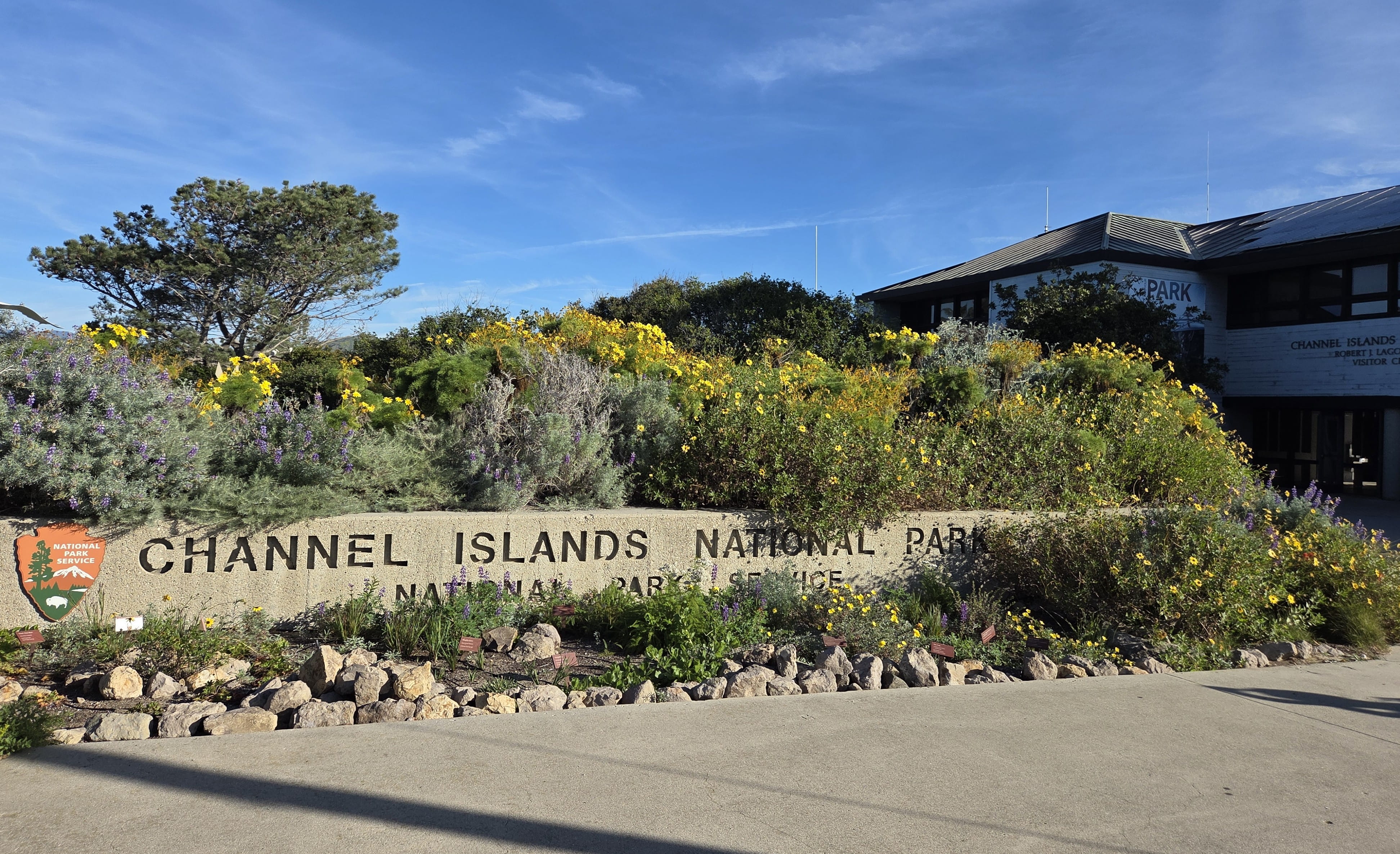
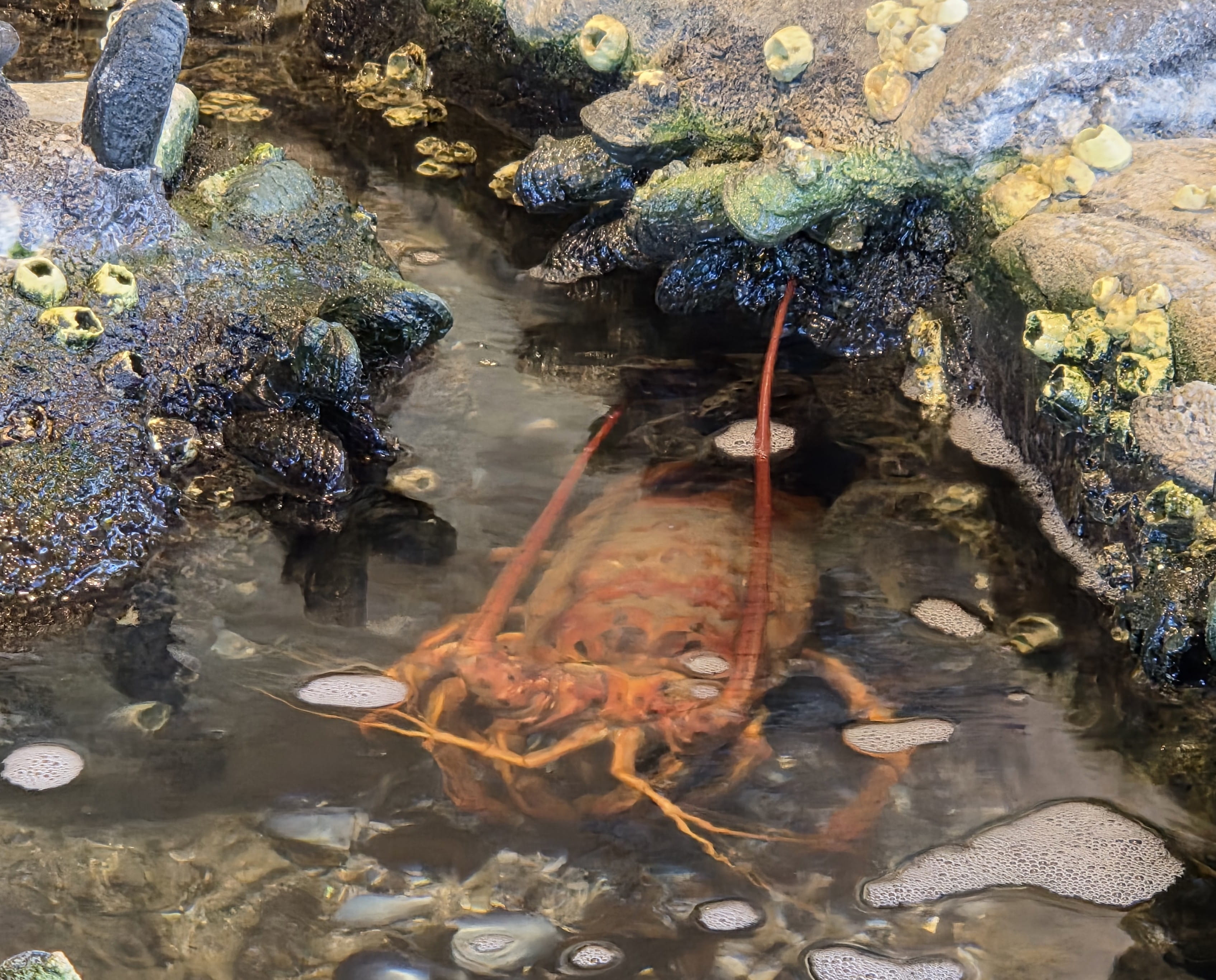
The visitor center opened at 8:30am. We went in to get stamps. (Very important for Rei!) I also purchased a Channel Islands NP baseball cap because I forgot to pack a hat! (I thought I did.) There’s a large fish tank inside the visitor center with a couple of fish and a lobster! The ranger also informed us that we could take the elevator to the top level, where there was a great view of the islands.
I booked a boat ride to Santa Cruz Island with Island Packers. Our boat ride was at 10am. Island Packers office was only 1/3 mile from the visitor center, so we walked there. We checked in shortly after 9am and waited in line with other passengers. There were many people going on this boat ride, including several families with young children.
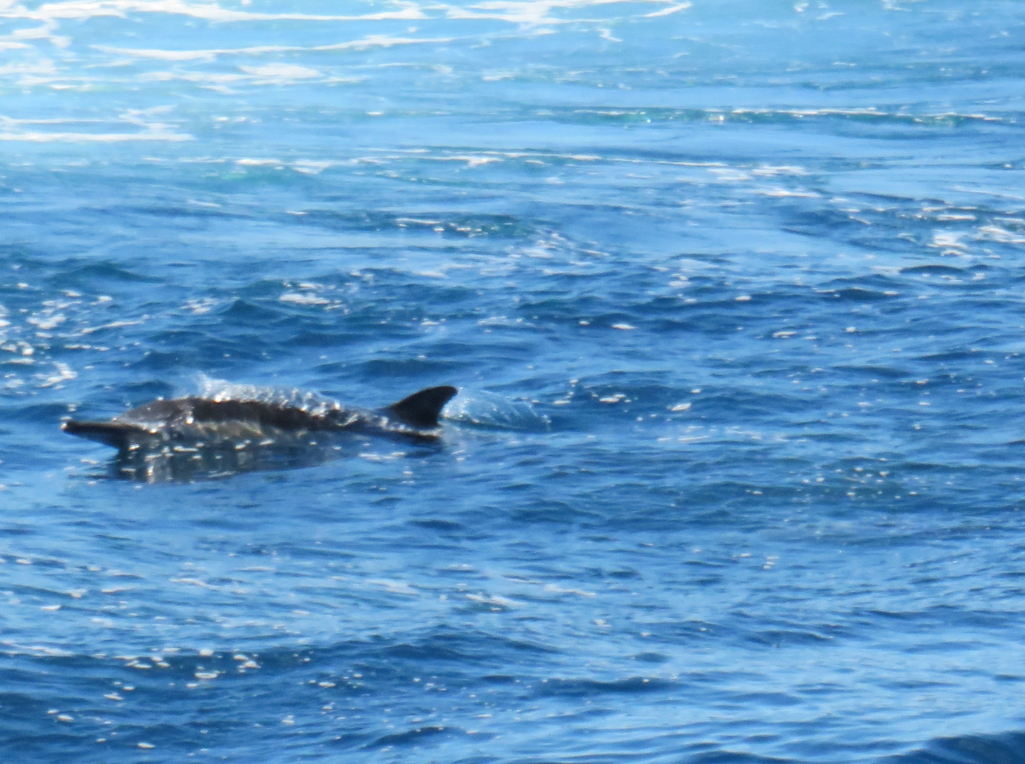
Rei and I sat at the upper deck. Less than half an hour of boat ride, we saw a large pod of dolphins swimming around. The crew stopped the engine, and we all took a lot of photos and videos of the dolphins.
The ocean was calm today, but the boat ride was still a little bumpy. Rei and I both took a motion sickness pill this morning, so we were okay.
Later, some passengers saw a whale, but I only saw some water splash.

When we reached Santa Cruz Island Scorpion Anchorage pier, we had to attend a mandatory orientation. Park Ranger Austin informed us the basic rules: pack-in-pack-out, not removing anything from the island, keeping hydrated, putting on sunscreen, and staying away from the cliff edges.
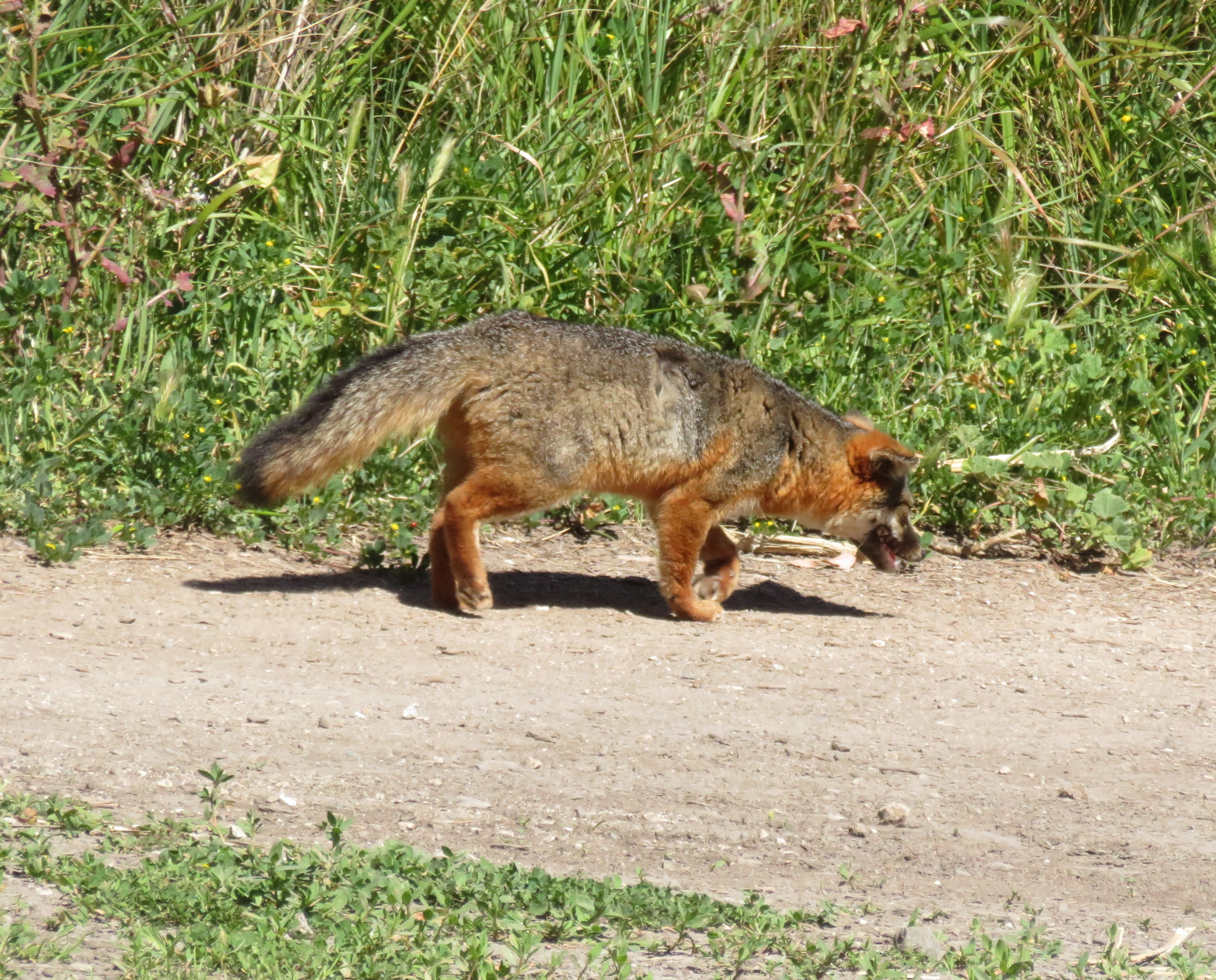
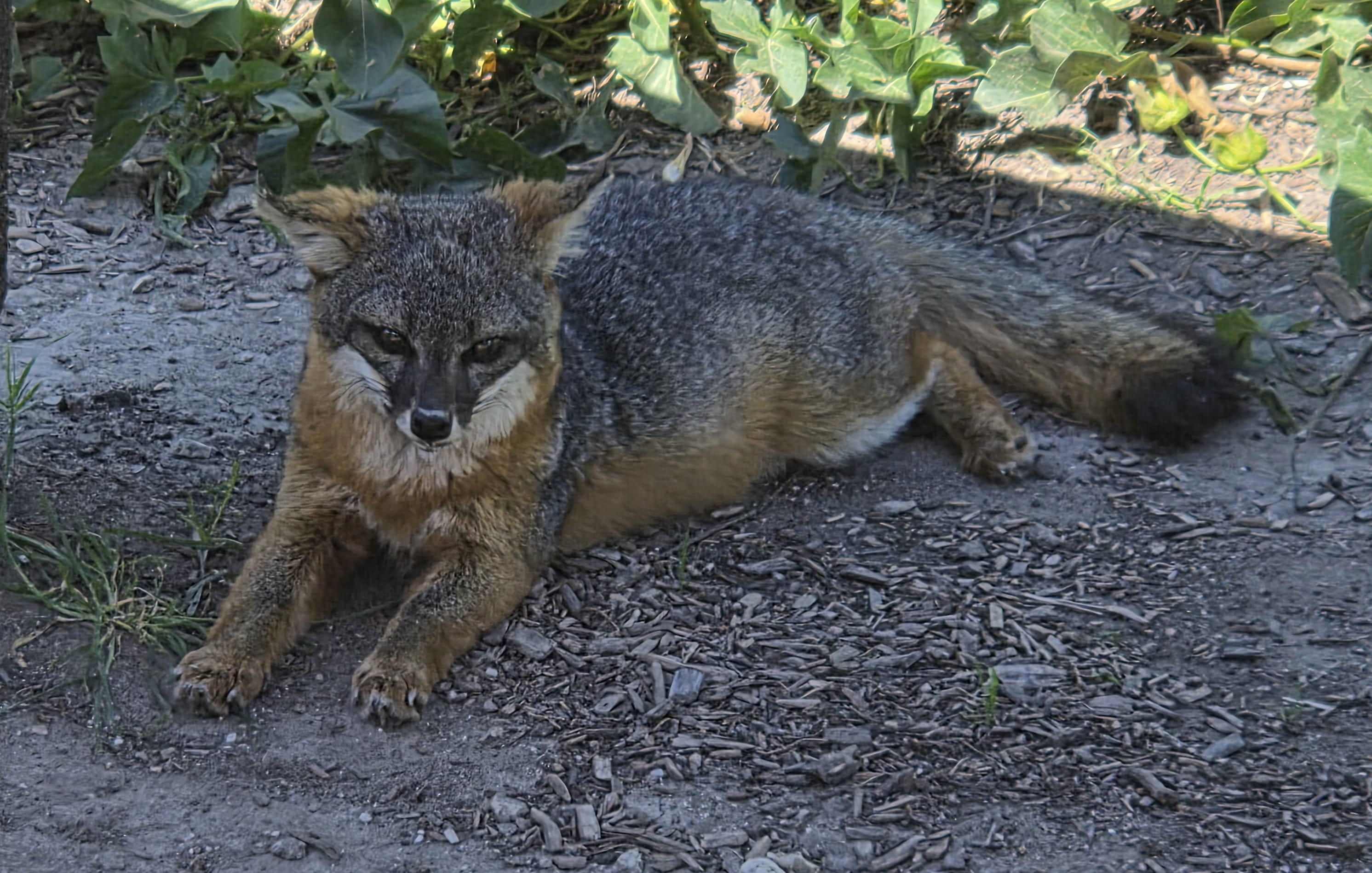
It was already 11:30am. Though most people started hiking right away, Rei and I decided that we should have lunch (bread, bananas and apples) first. This turned out to be a great decision, because there was a small fox running around the area, and we were able to take photos and videos. The small fox was so cute!
The island also had a small, unmanned visitor center with a stamping station. Rei was thrilled to get another stamp. (This one said Santa Cruz Island.)
We started to hike after 12pm. Rei agreed to put on some sunscreen because the range said so. (He usually refused to do so.)
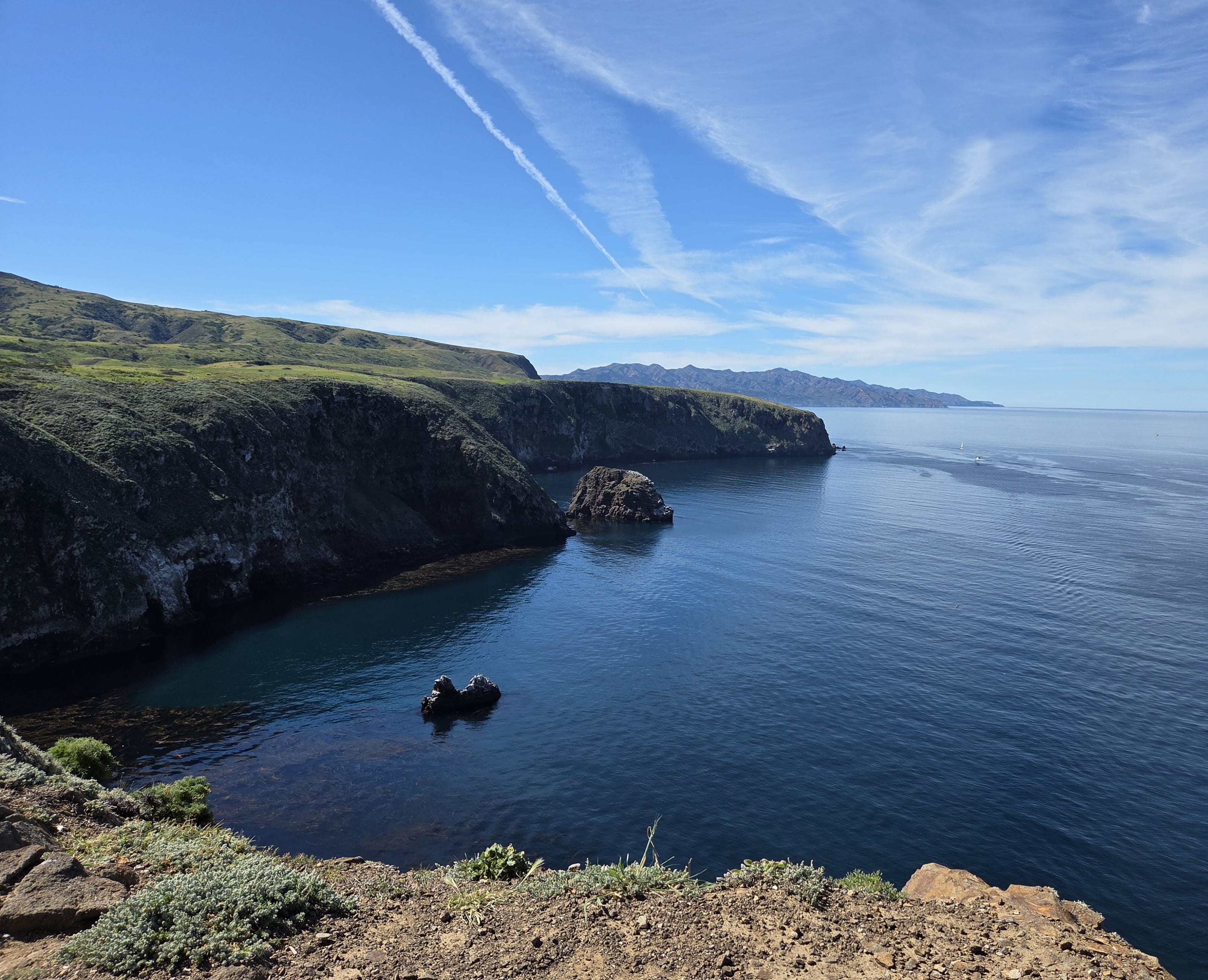
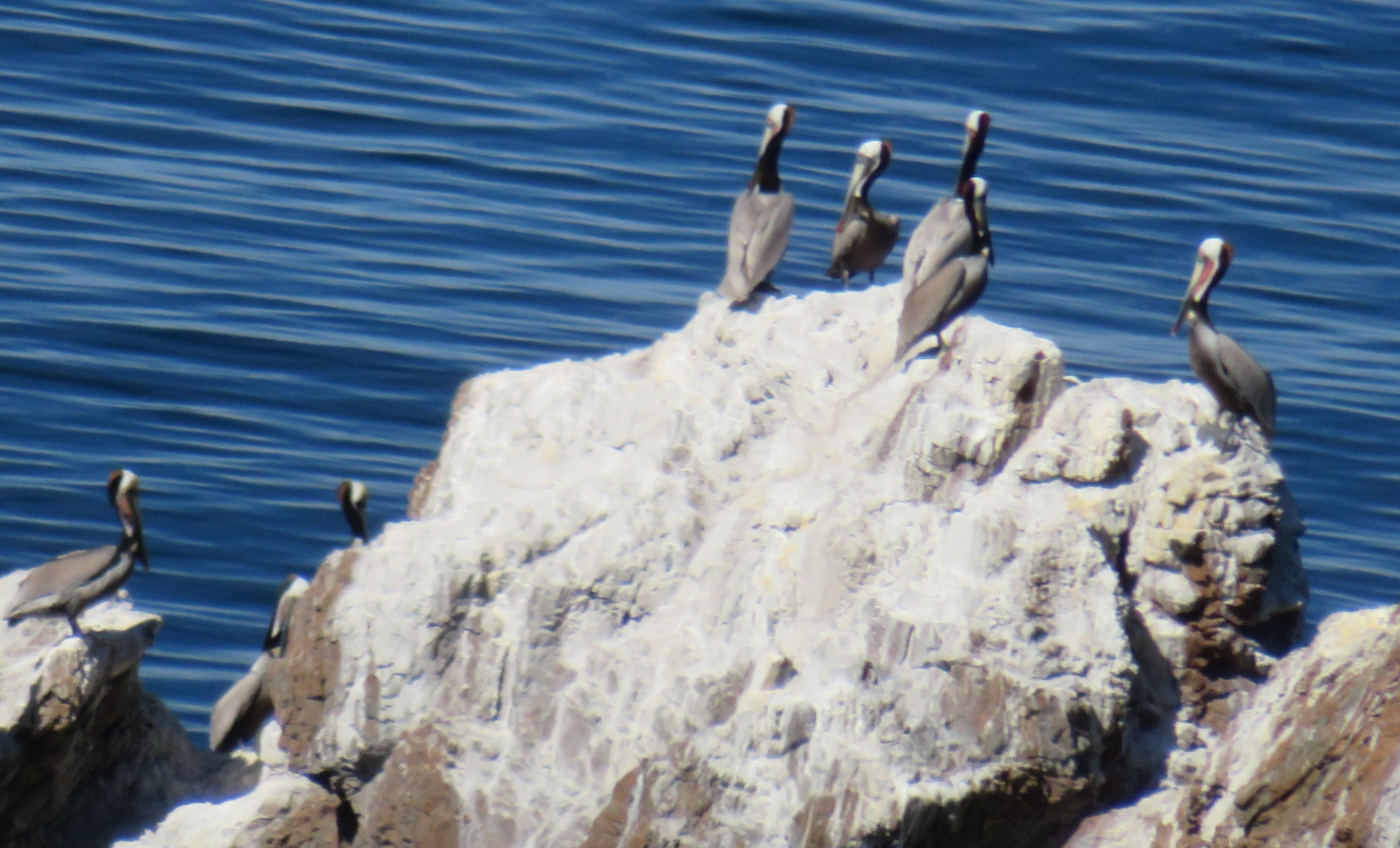
There were a lot of bright yellow mustard flowers and white morning glory flowers covering the hills. We first climbed to Cavern Point. The place offered a splendid view of the ocean and the islands! We also saw brown pelicans resting on rocks.
Then we continued to Cavern Point Trailhead. We saw a ranger leading a group of volunteers cleaning the path and removing some vegetation.
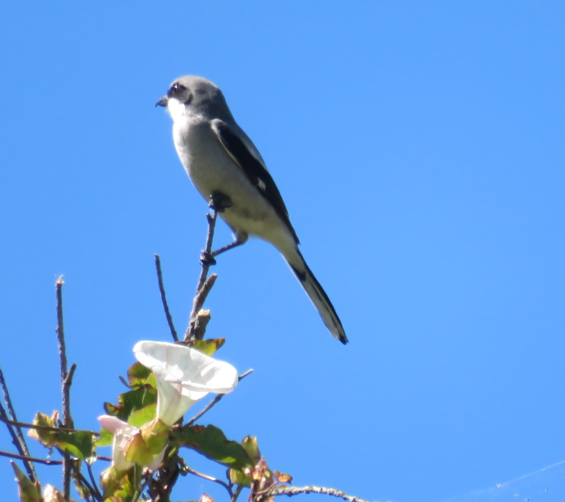
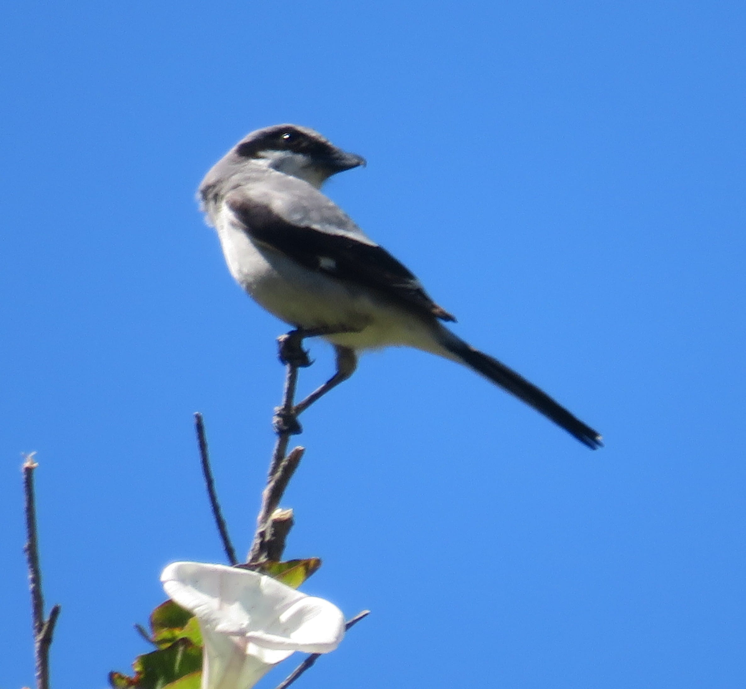
It was only shortly after 1pm. The trail returning to Scorpion Anchorage pier was less than 2 miles, so we decided to continue to Scorpion Canyon Loop Trail instead. The place was verdant with many plants and birds. I spent some time photographing an Island Loggerhead Shrike perching on a branch, but Rei told me that we had to keep going. After a while, I asked Rei how far we still had to walk. He checked his phone and told me that we needed to walk about 2 more miles.
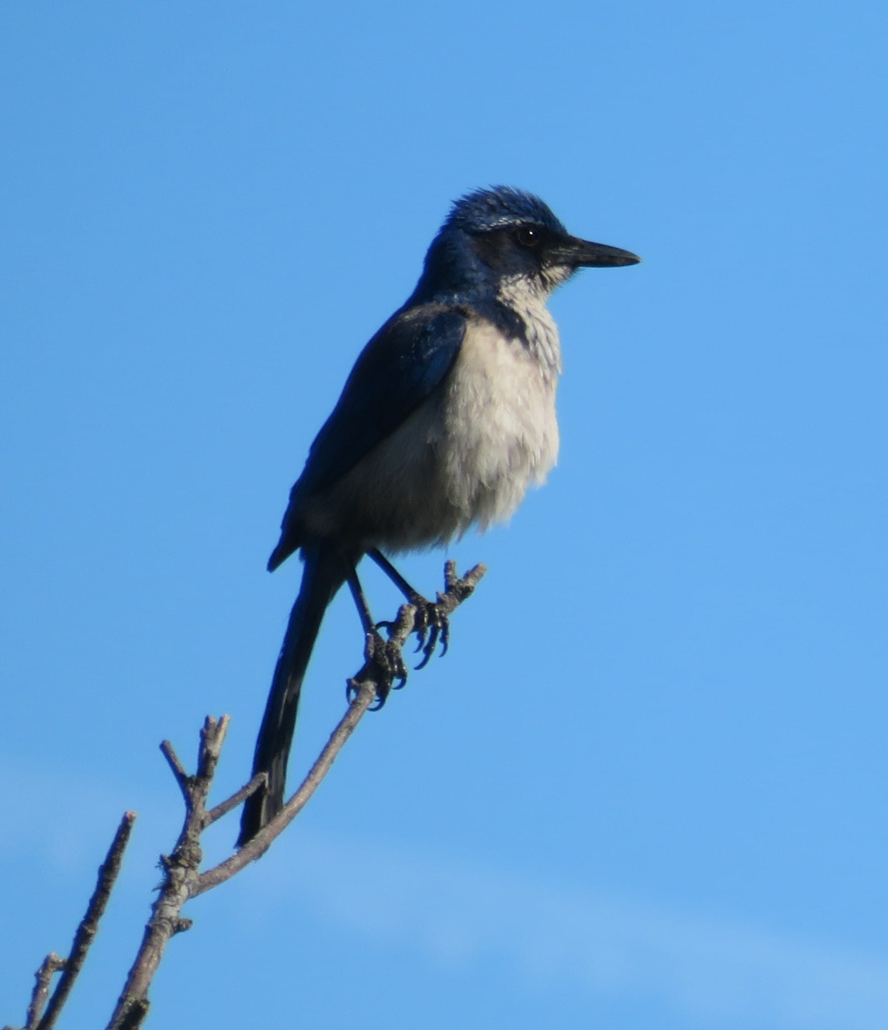
The next section of trail was a challenging uphill climb. The weather became very warm, so we had to drink a lot of water. I saw two jays flying around. I thought they were common Western Scrub Jays. Later I found out that they were actually Island Scrub Jays only found on Channel Islands! After 20 minutes of climbing, I asked Rei again how far we had to continue walking. He checked his phone and again told me 2 more miles.
There was more uphill climbing under the hot sun. After another 15 to 20 minutes of climbing, we crested a hill. The sign there showed that Scorpion Anchorage pier was 2.3 miles away!
Fortunately, the rest of the hike was mostly downhill. Moreover, we found a sign showing a short cut that further shortened the distance. When we finally returned, it was just 2:30pm.
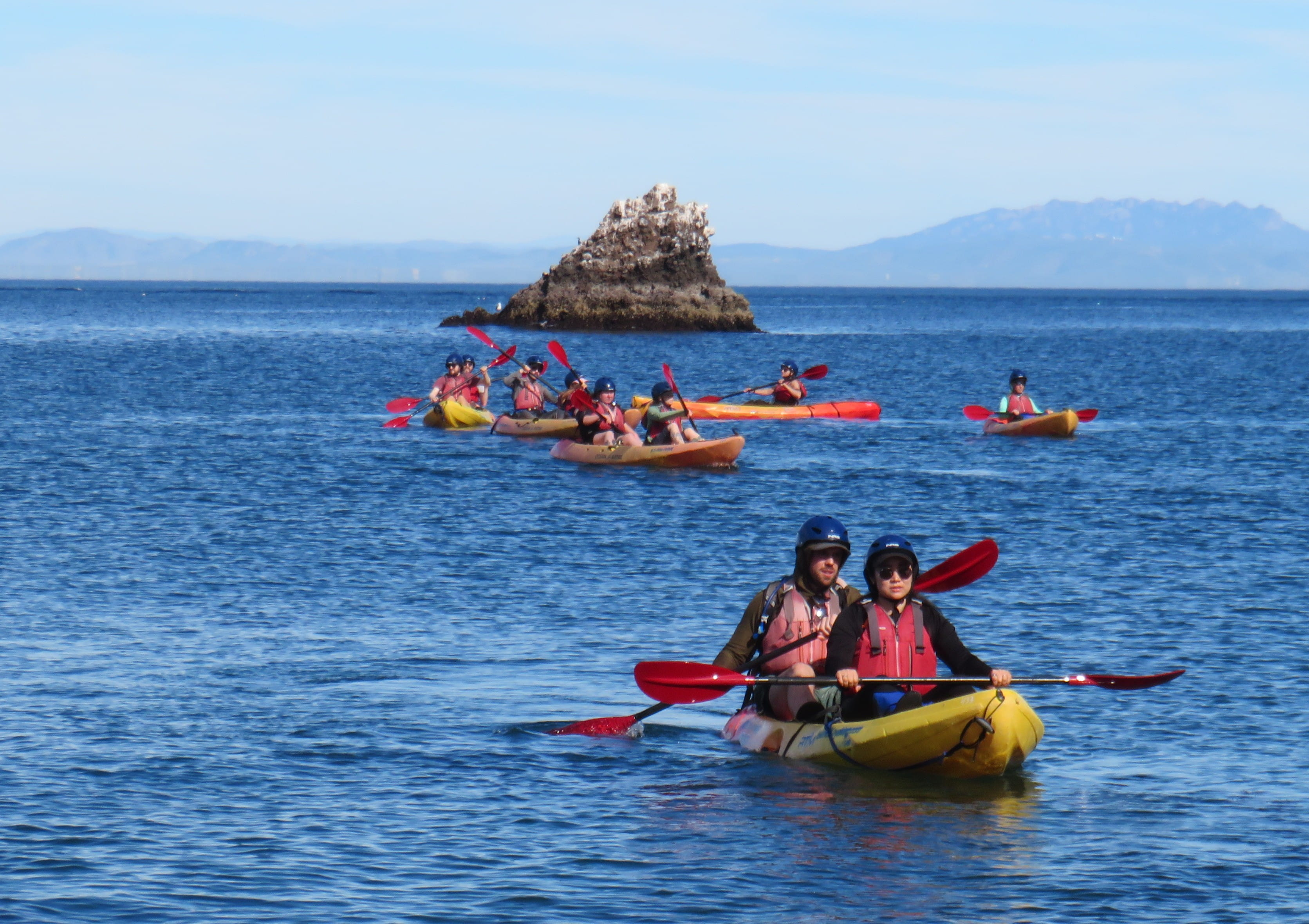
Rei suggested that we stop by the beach first. There were many swimmers and kayakers in the beach area. When we reached the beach, Rei decided to step into the ocean too.
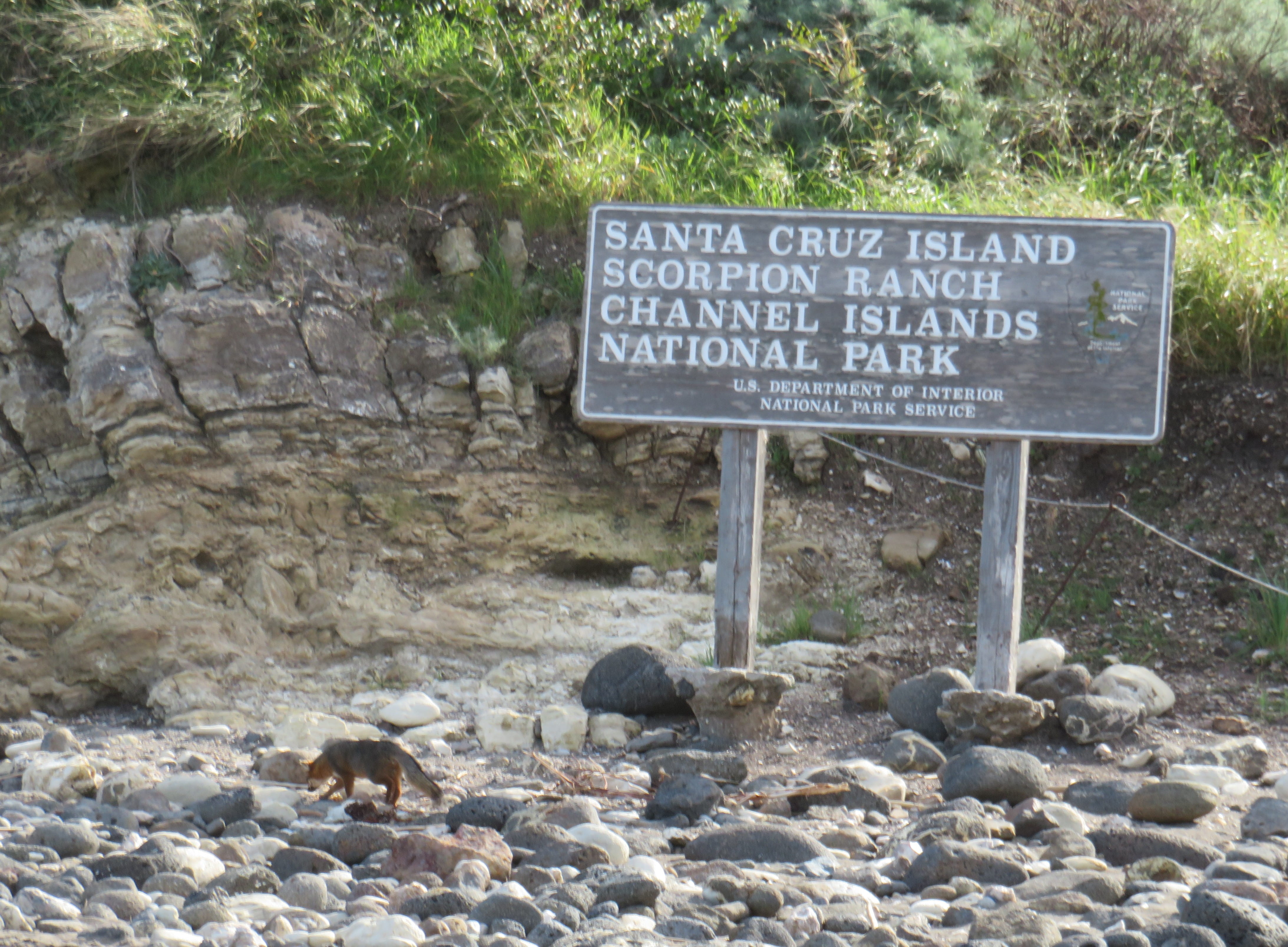
We saw a small fox running around at the beach. I wasn’t sure whether it was the same fox we saw earlier or not – they all looked the same.
When we walked back to the pier, they were boarding the 3pm group. Our return tickets were at 3:30pm, but they allowed us to board the boat.
The sea was very calm. The returning boat ride was smoother than this morning’s boat ride. We didn’t see any dolphins though.
When we returned to the hotel, it was not yet 5pm. We were both dusty and sweaty, so we took a shower first before going out for dinner.
There’s a Shake Shack just outside the hotel, so we simply went there to have hamburger and chicken burger.
We enjoyed today’s trip very much and were already considering a different boat ride with Island Packers in the future.
Day 3: Manzanar National Historic Site
We checked out and started to drive to Manzanar National Historic Site shortly after 8am. I assured Rei that we could get a national park stamp there too, and he was very satisfied.
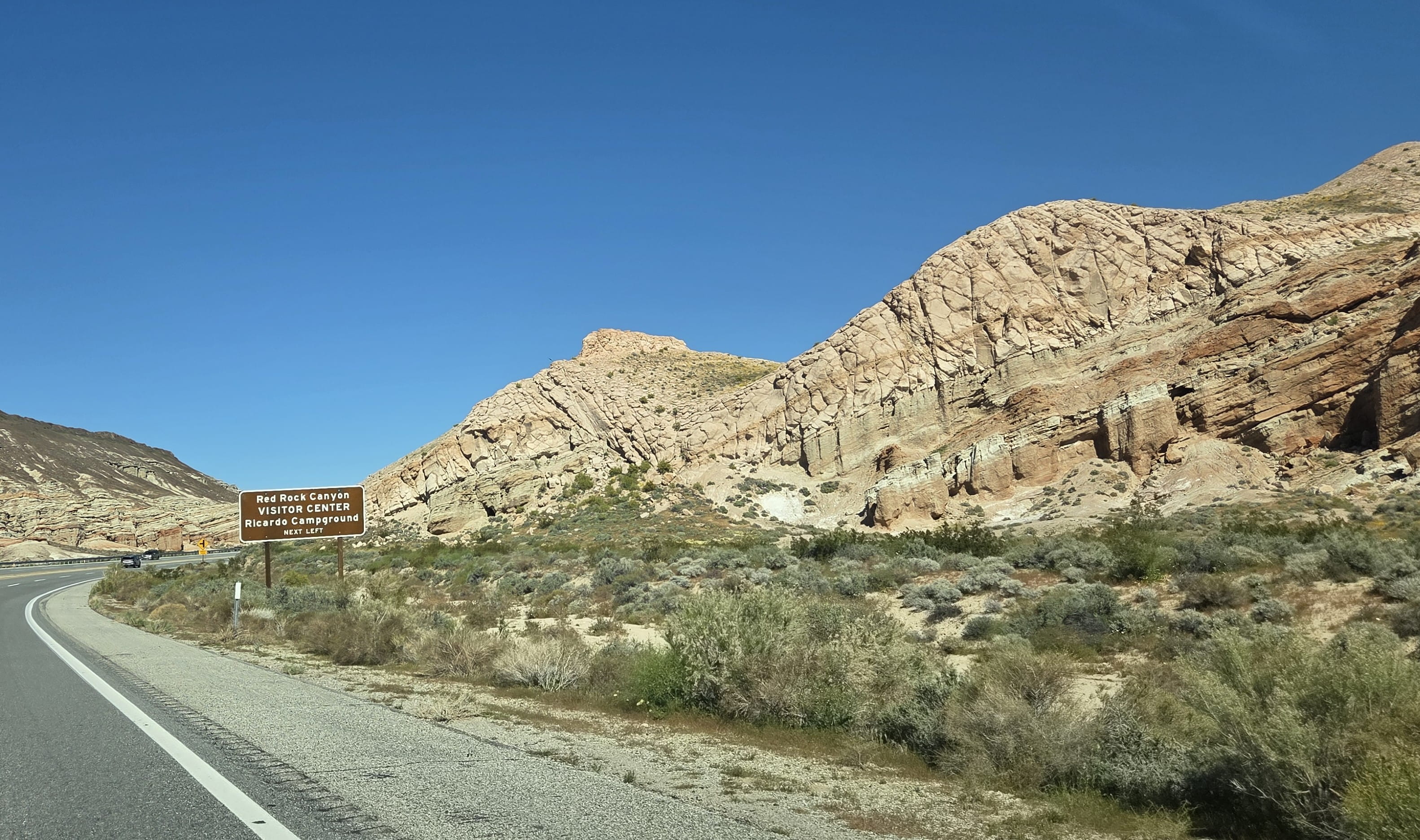
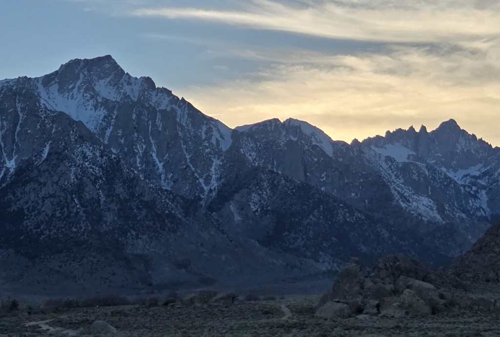
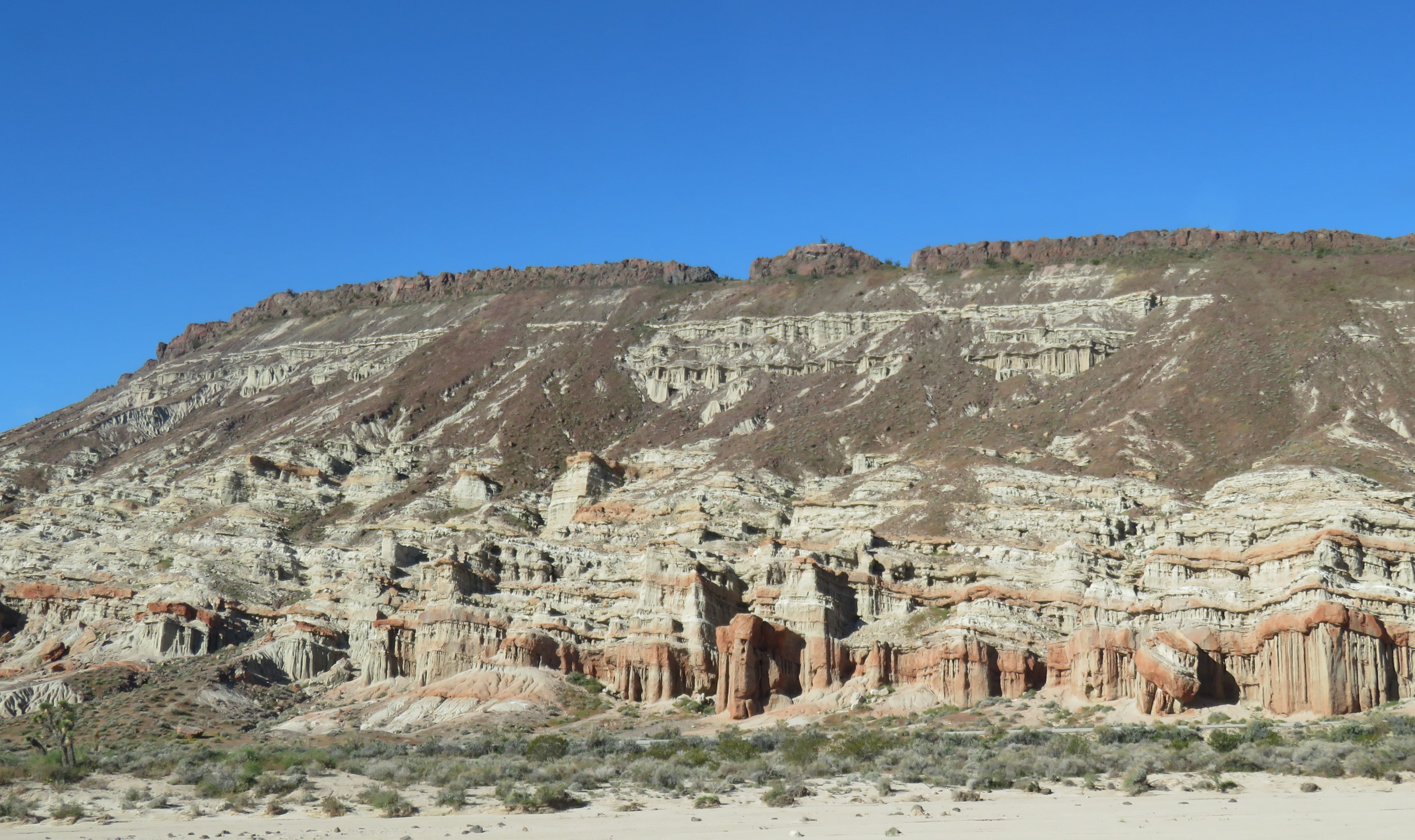
After we got on Hwy 14, we could see California Poppy blooming on hills! When we were close to Red Rock Canyon State Park, we could see colorful and interesting rock formations. Later, we also saw Joshua Trees along the road. When we were driving on Hwy 395, we could see multi-colored painted hills on our right and snowcapped Sierra Range mountains on our left. Though this was a very long drive, we enjoyed scenic views most of the way and were never bored.
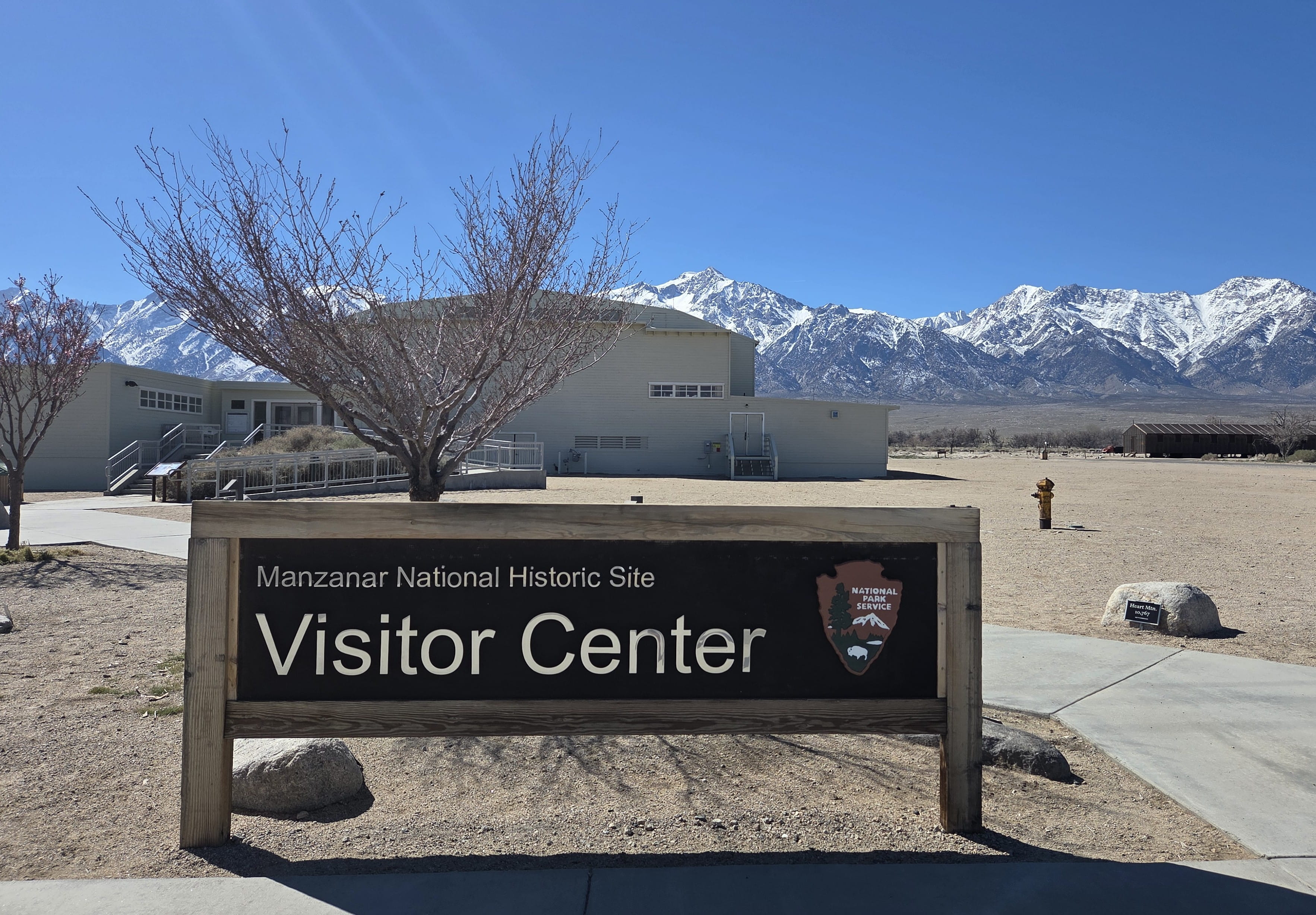
It was just past noon when we arrived at Manzanar National Historic Site. A very helpful ranger informed us that they were about to start an introductory movie in the auditorium. Rei and I immediately went there to watch the movie.
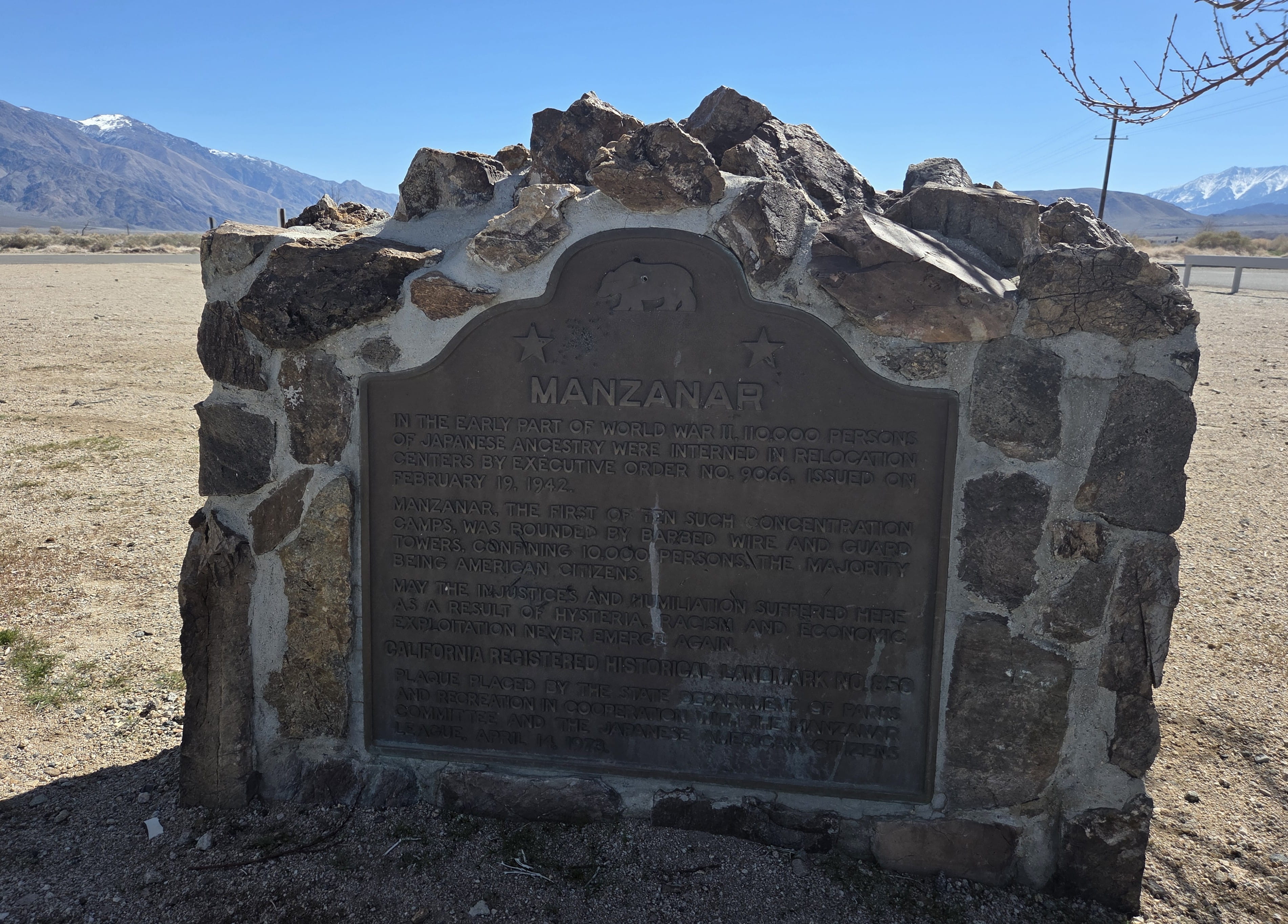
After Japanese bombed Pearl Harbor on December 7, 1941, Japanese Americans were treated as “enemies within” and were much hated. The US government ordered to have all people with Japanese ancestry to be “relocated” to certain locations guarded by the military. Those people had to abandon most of their belongings to be forcefully moved.
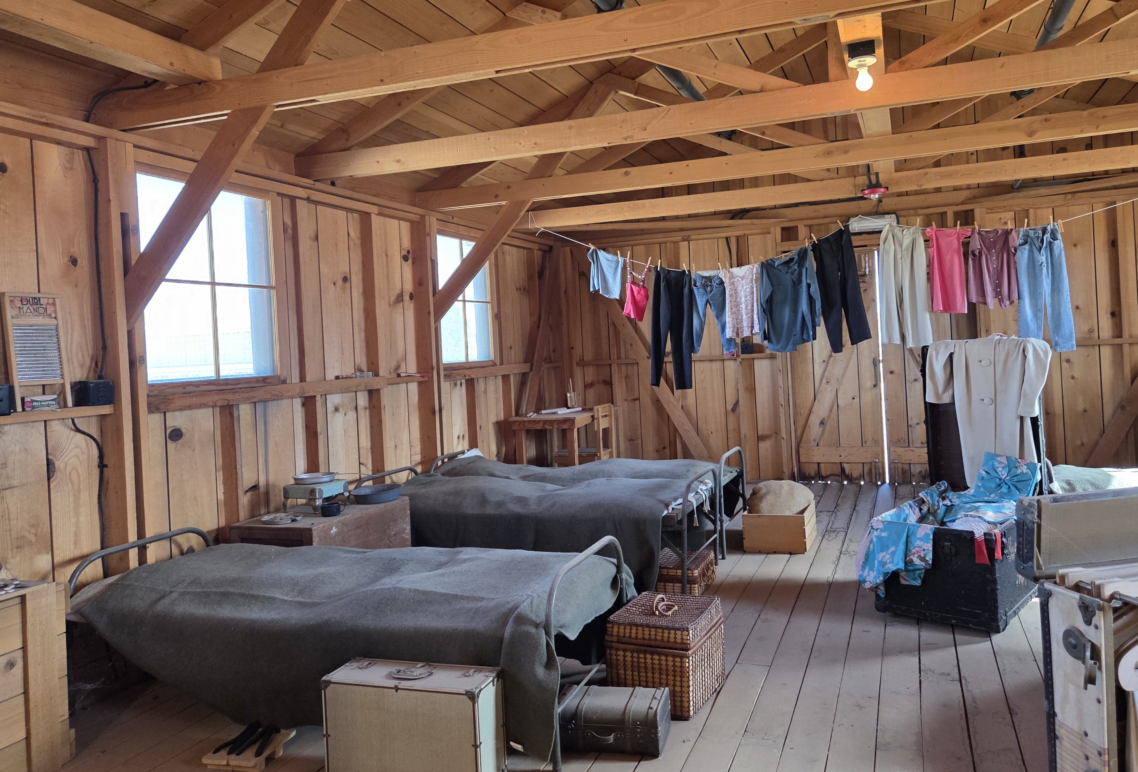
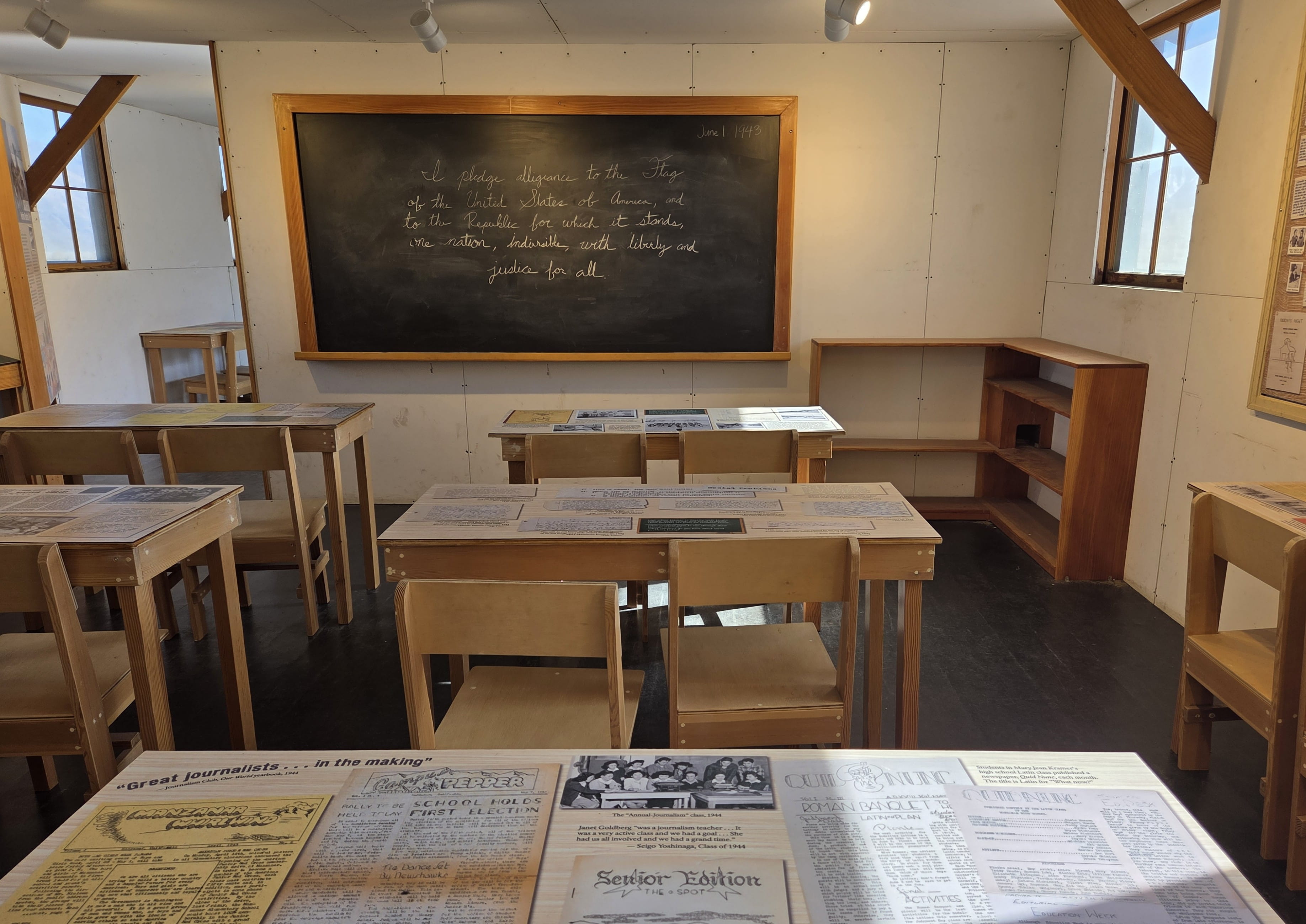
At Manzanar, people first stayed in dorm-like buildings. Eventually their living conditions improved so that families had their own tiny living space. There were also a school and a Mess Hall serving subpar meals. People were not allowed to leave, and they left like they were imprisoned.
This was a great injustice to those Japanese Americans living in the United States. There was a lot of resentment, especially among those second-generation Japanese Americans, who considered themselves authentic Americans.
Eventually Manzanar was closed in late 1945, and people moved out. However, they were all negatively affected by the horrible experience.
Finally, President Reagan publicly admitted that it was wrong for the US government to forcefully removed Japanese Americans from their homes to internment camps. Apology letters and compensations were later sent to the internees.
Manzanar is now a national historic site to remind all of us of the past injustice act. People will have to learn from history and to remember the previous mistakes in order not to commit them again.

Rei and I spent a couple hours driving and walking to see different sites, which including a Japanese garden and orchard, Cemetery Monument, and reconstructions of residential blocks, school classrooms, lavatory and mess hall.
This was a quiet and somber place. It wasn’t crowded with visitors. We counted only about 15 cars in the parking lot when we were leaving.
After the visit, we drove to check into tonight’s hotel in Lone Pine. We got an Alabama Hills pamphlet at the Manzanar visitor center. The photos looked very impressive. It was very close to our hotel, so we drove there after checking in and moving all the stuff in the car to our room.
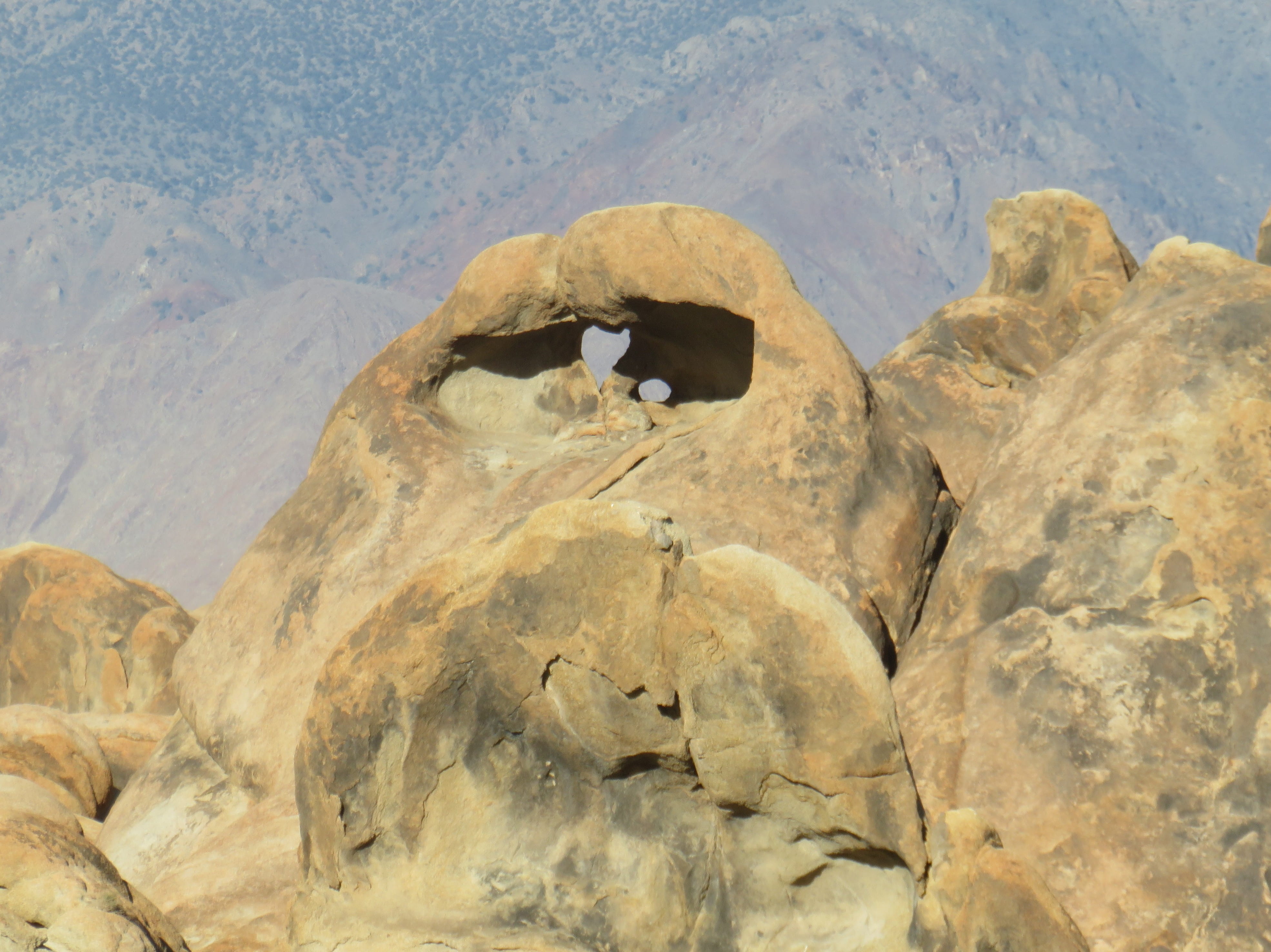
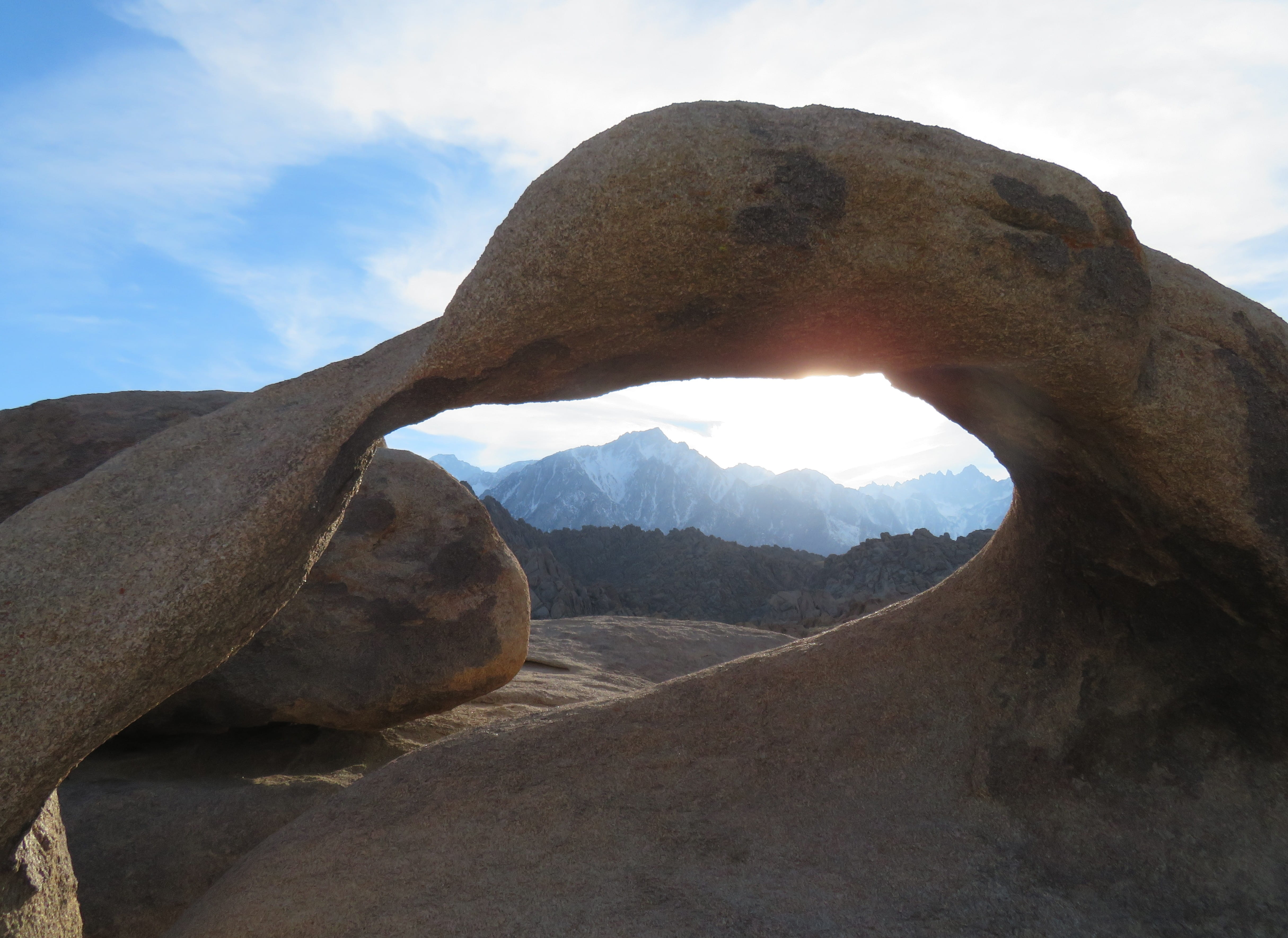
Alabama Hills had many interesting rock formations. It looked like Joshua Tree National Park minus Joshua Trees. We parked the car to walk along the Arch Loop Trail. There were some trail signs but little else. I wouldn’t have recognized Heart Arch if I hadn’t seen the photos on the web. At least Mobius Arch was easy to find.
We had to rely on the help of Google Map to locate Eye of Alabama Hills Arch. It was a much smaller arch and wasn’t very impressive.
Alabama Hills had a long history of western filming. Hundreds of movies were filmed there, and there’s a museum too. The map we had showed several movie filming sites. I rarely watch movies. (I prefer reading instead.) Rei, though enjoyed movies, was not familiar with the movies mentioned in the pamphlet. Therefore, we didn’t spend time locating those filming sites.
We could see many snowcapped high mountains, but we weren’t sure which one was Mount Whitney, the highest peak in the contiguous United States. The one we thought was Mount Whitney turned out to be Lone Pine Peak. A map we finally found on the geology trail showed us the correct Mount Whitney, which was farther out on the right and looked smaller.
It was getting late. We stopped by The Grill to have dinner before returning to our hotel room to wash up and to rest.
Day 4: Death Valley National Park
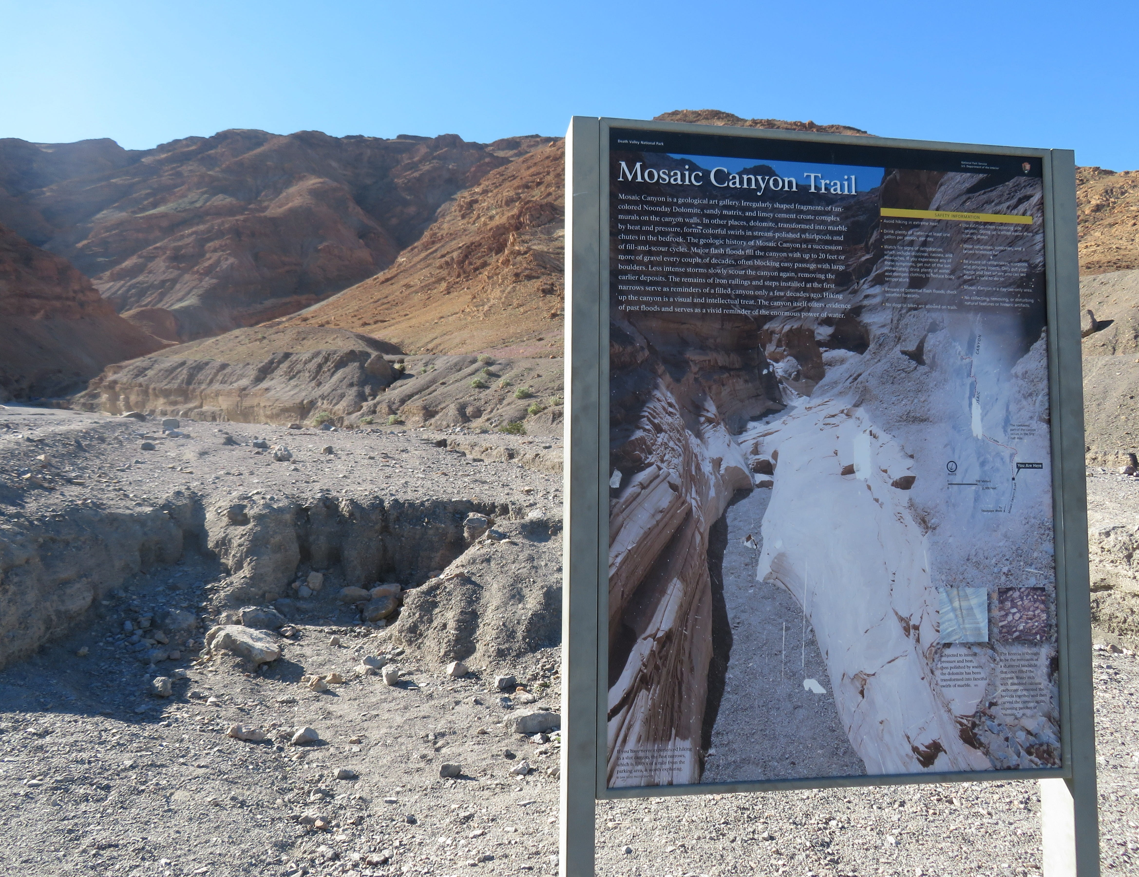
During our last visit to Death Valley National Park, we arrived too late to Mosaic Canyon trailhead, and we only had time to walk less than one mile into the canyon. This time we determined to walk the entire distance.
Because Death Valley would reach 90oF in midday, we had to start early to avoid the heat. We left the hotel shortly after 7am to drive to Stovepipe Wells, where the trailhead started. The last section of the drive was on a dusty gravel road. Rei had to drive very slowly. We were surprised that there were many cars parking at the almost full parking lot. Rei managed to get one of the last spots.
We started to hike around 9am. At the canyon’s mouth, we saw painters setting up easels and capturing the views. There was also a very large group of young adults on their geology class field trip. No wonder there were so many cars in the parking lot!
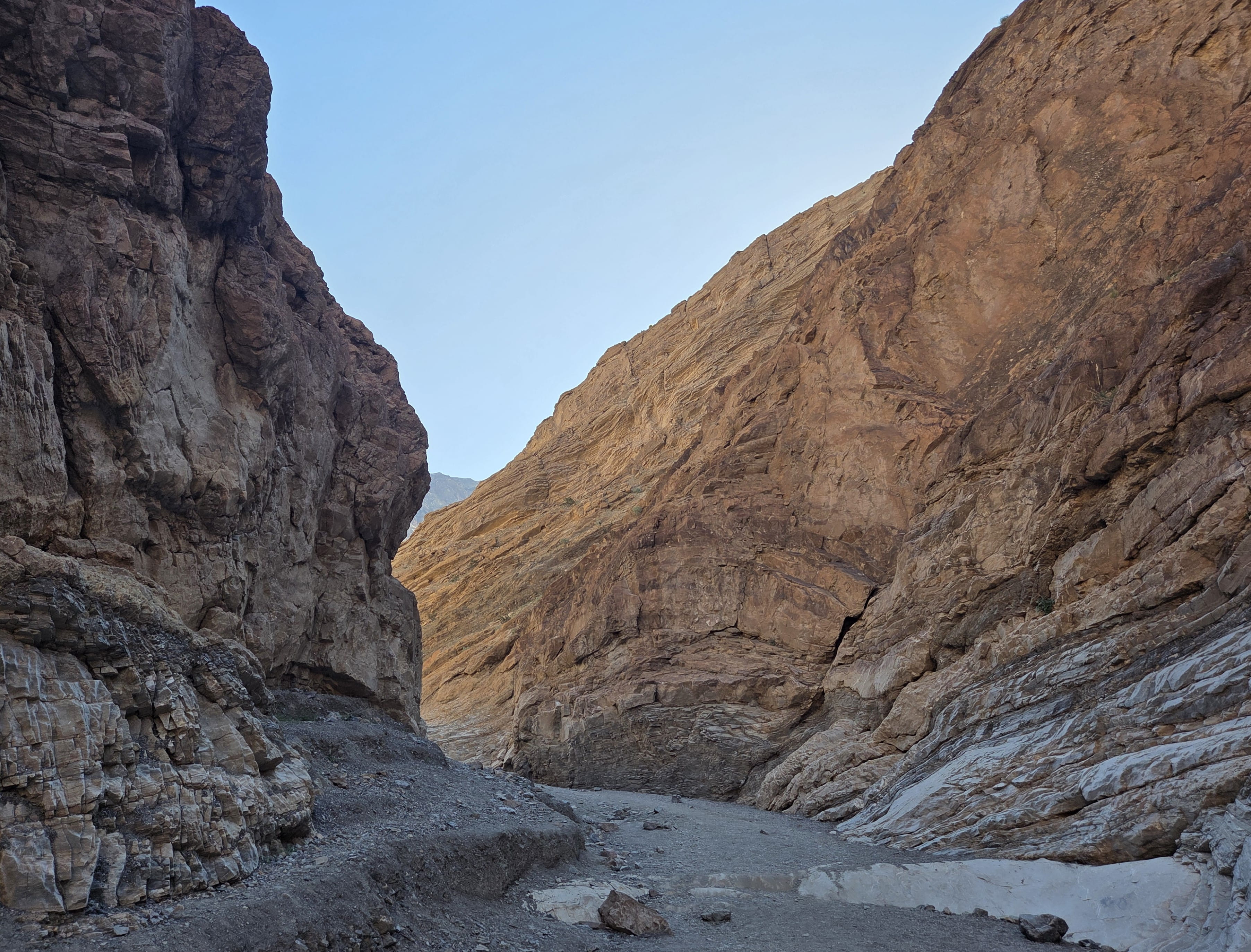
After almost 20 minutes of walking, we reached the place where we turned around last time. This time we continued forward. There were also many other hikers on the same trail.
Further down, the trail became more like an obstacle course. We had to climb up some very slippery rocks to proceed. At some point, Rei helped push me to the top, and then I helped pull him up. We also helped a couple of other hikers up.
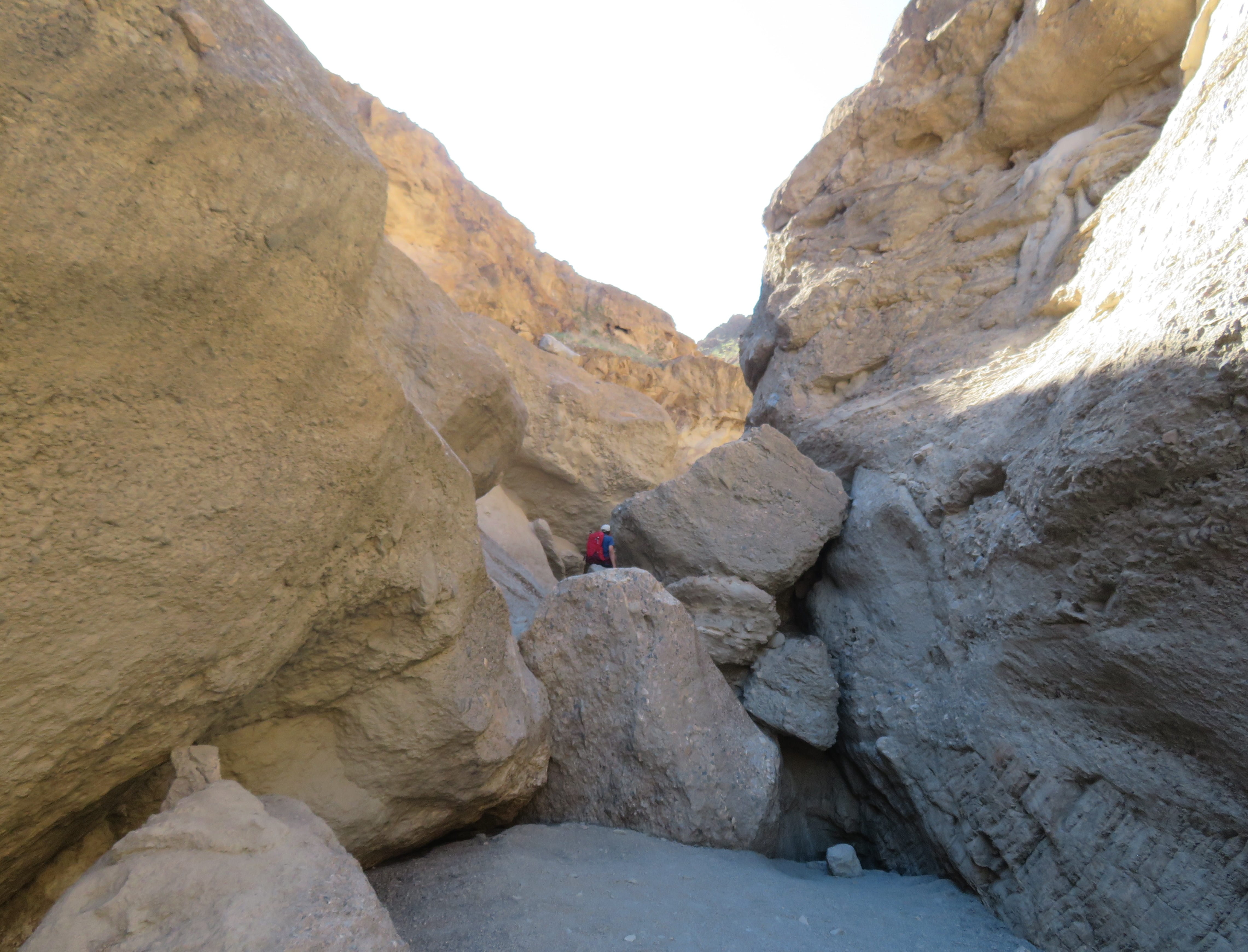
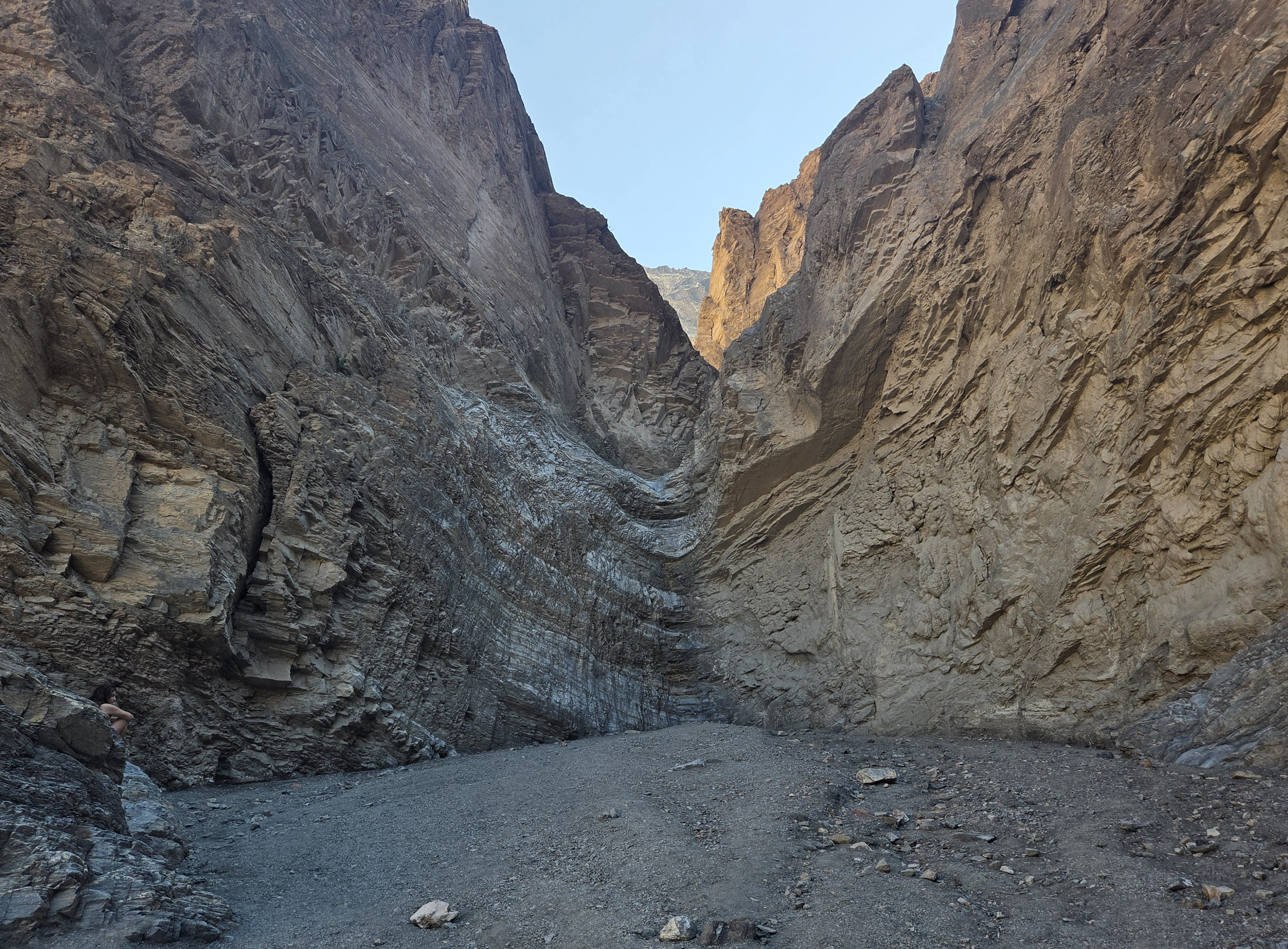
Some parts of the trail weren’t obvious, and hikers had to backtrack to find the right path. It was past 10am when we reached the end of this 2-mile hike. There was supposed to be a small waterfall at the end of the trail. To our great disappointment, the waterfall was completely dry! However, all hikers were taking photos anyway to prove that we have done this.
The return trip was easier. This time we only needed to slide down the slippery rock surfaces, and it was quite fun too. It took us only about 45 minutes to return to our car.
We drove to the Stovepipe Wells general store, where there were several picnic tables under the shade, to have our packed lunch (bread and apples).
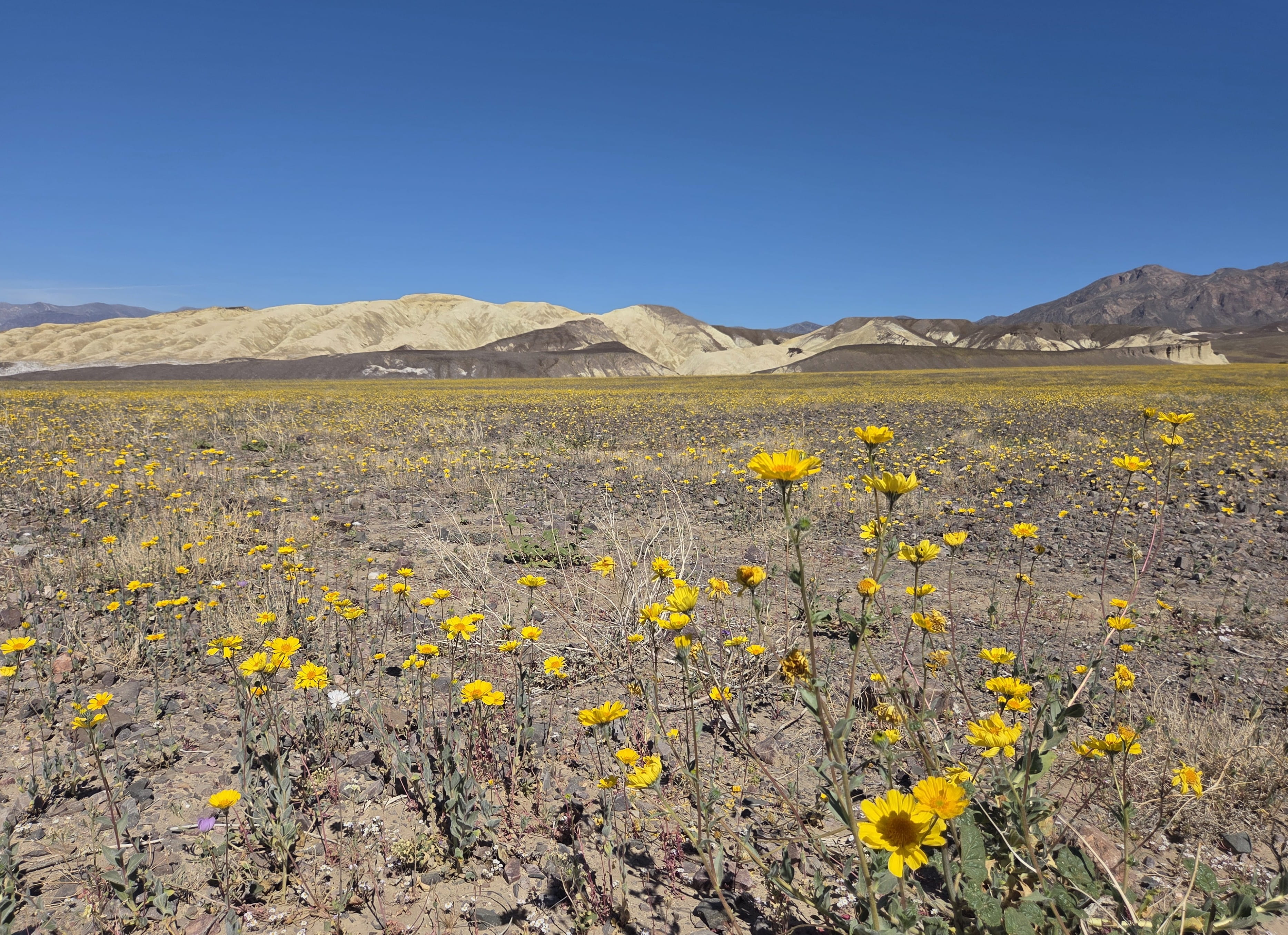
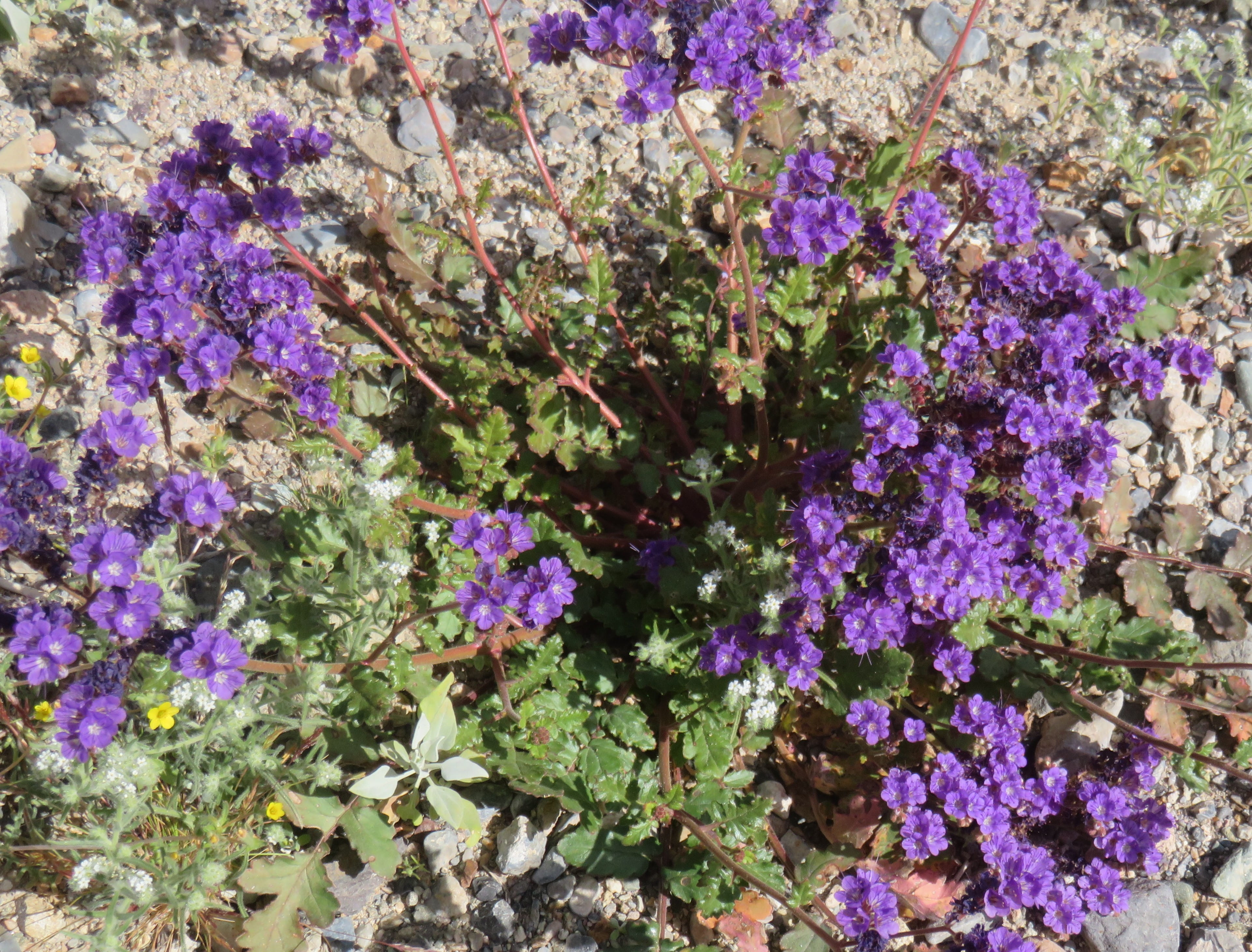
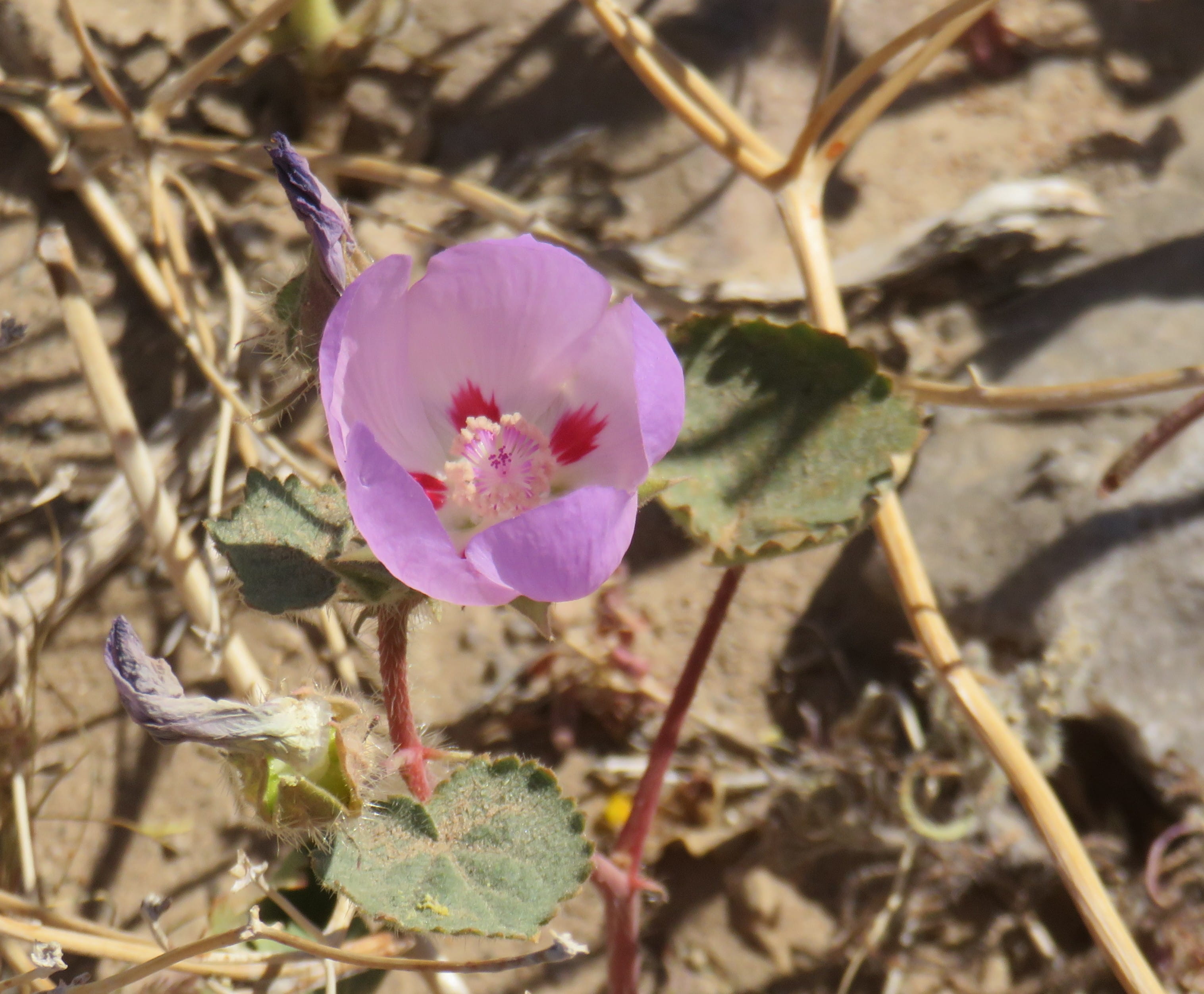
Rei checked with a ranger and was told that there would be wildflowers near Furnace Creek visitor center. One the way there, we could already see many large patches of yellow Desert Gold flowers carpet the meadow. Many cars stopped along the roadside for passengers to take pictures. We also made many photos stops on the way. In addition to Desert Gold, we also saw a lot of purple Notch-leaf Phacelia flowers and some beautiful Desert Five-Spot flowers.
We decided not to continue down to Badwater since we were just there less than 3 months ago and we were already tired. Therefore, we simply turned around to drive back to Lone Pine.
We saw many big clusters of yellow flowers on the mountain this morning, but we didn’t stop to take pictures. This time, we made a couple of photo stops. These yellow flowers were not Desert Gold; they were most likely mountain or desert Mule Ears.
One the way back, we also stopped at a viewpoint. The view was surely splendid. However, the most interesting thing was an information board showing that the canyon was a military pilot training place nicknamed Star Wars Canyon due to the similar configurations.
Day 5: Antelope Valley Poppy Reserve
We’re driving home today. Our route would pass Mojave, and Antelope Valley Poppy Reserve was only less than 40 miles away. I suggested to Rei that we should stop by Antelope Valley to check out California poppies.
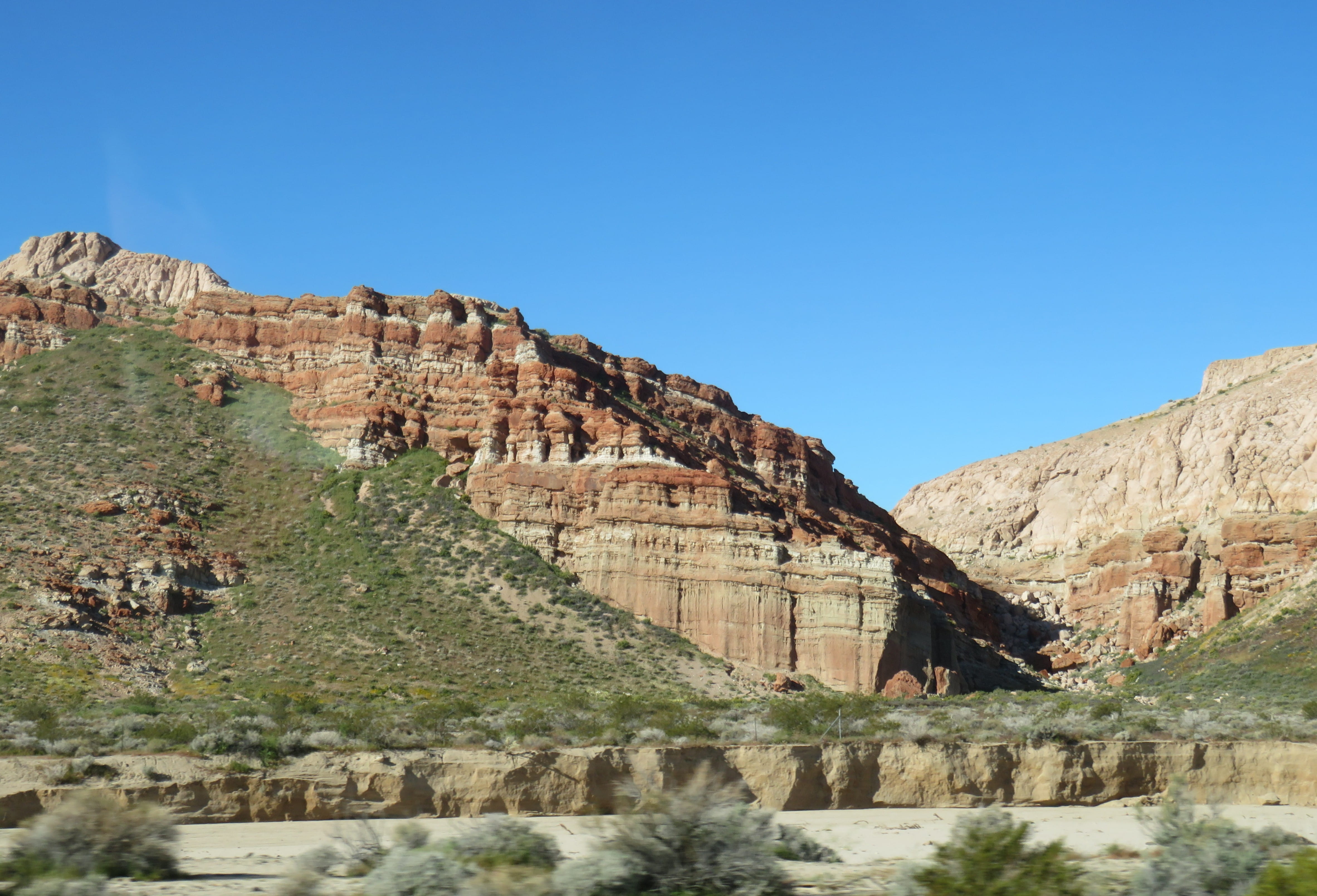
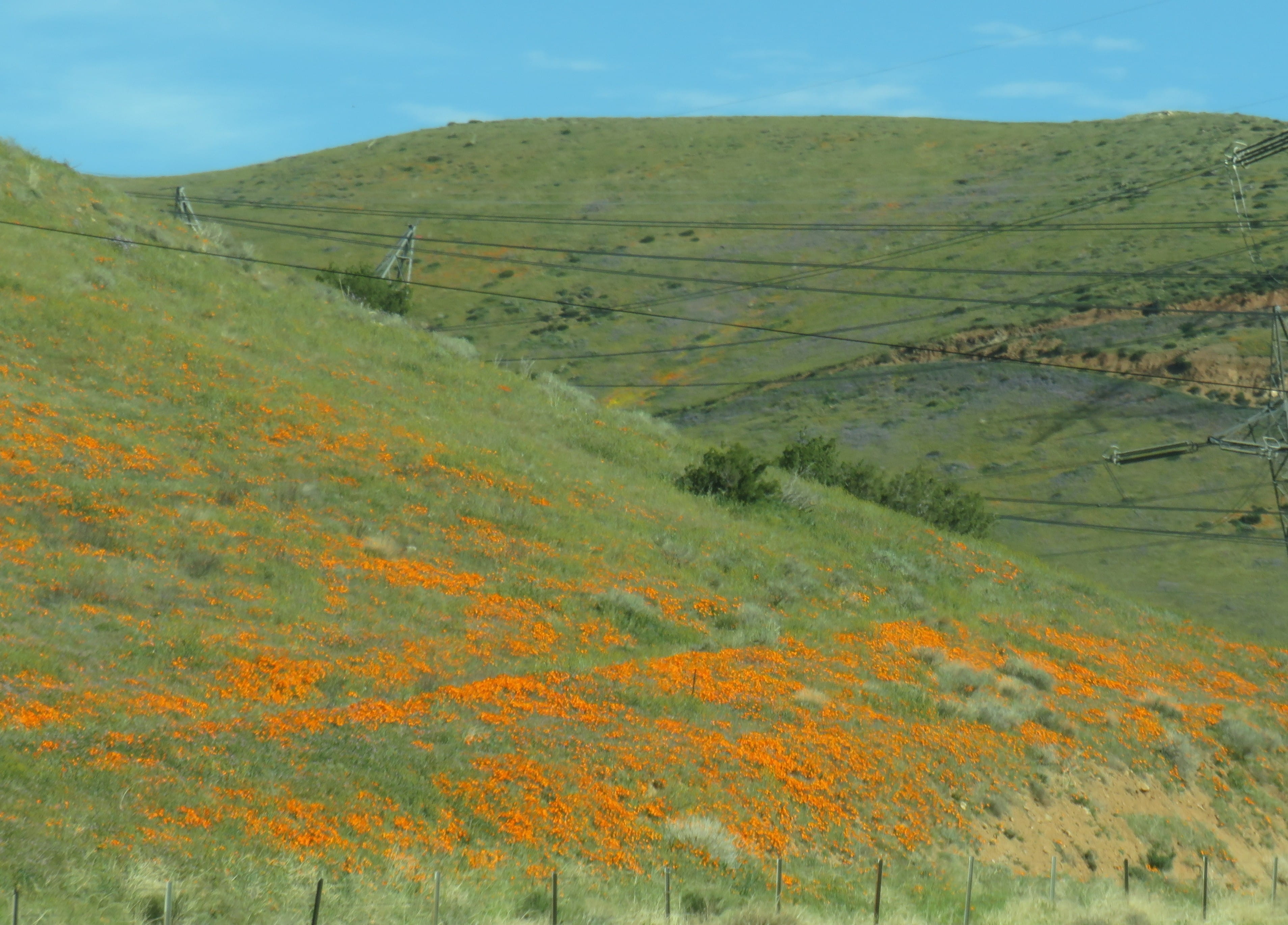
We checked out around 7:30am. Highway 395 Eastern Sierra Scenic Byway was indeed very scenic. There weren’t a lot of cars in the early morning. Then we turned to Hwy 14. The view near Red Rock Canyon State Park was amazing! This time I was on the “right side” of the car for taking pictures, and I took many pictures. We could also see beautiful multi-colored wildflowers on the way.
When we arrived at Antelope Valley Poppy Reserve, it was just about time for the visitor center to open (10am). The friendly volunteers inside the visitor center provided us with a lot of very useful information. We were told that visitors saw splendid poppy blooms in the last two days. Today, however, was very windy, and the flowers mainly stayed closed.
Armed with a wildflower identification guide and a trail map indicating the potential routes, Rei and I ventured out to explore the reserve by ourselves. Even though today was a weekday, there were other visitors braved the strong wind to see and to photograph the wildflowers.
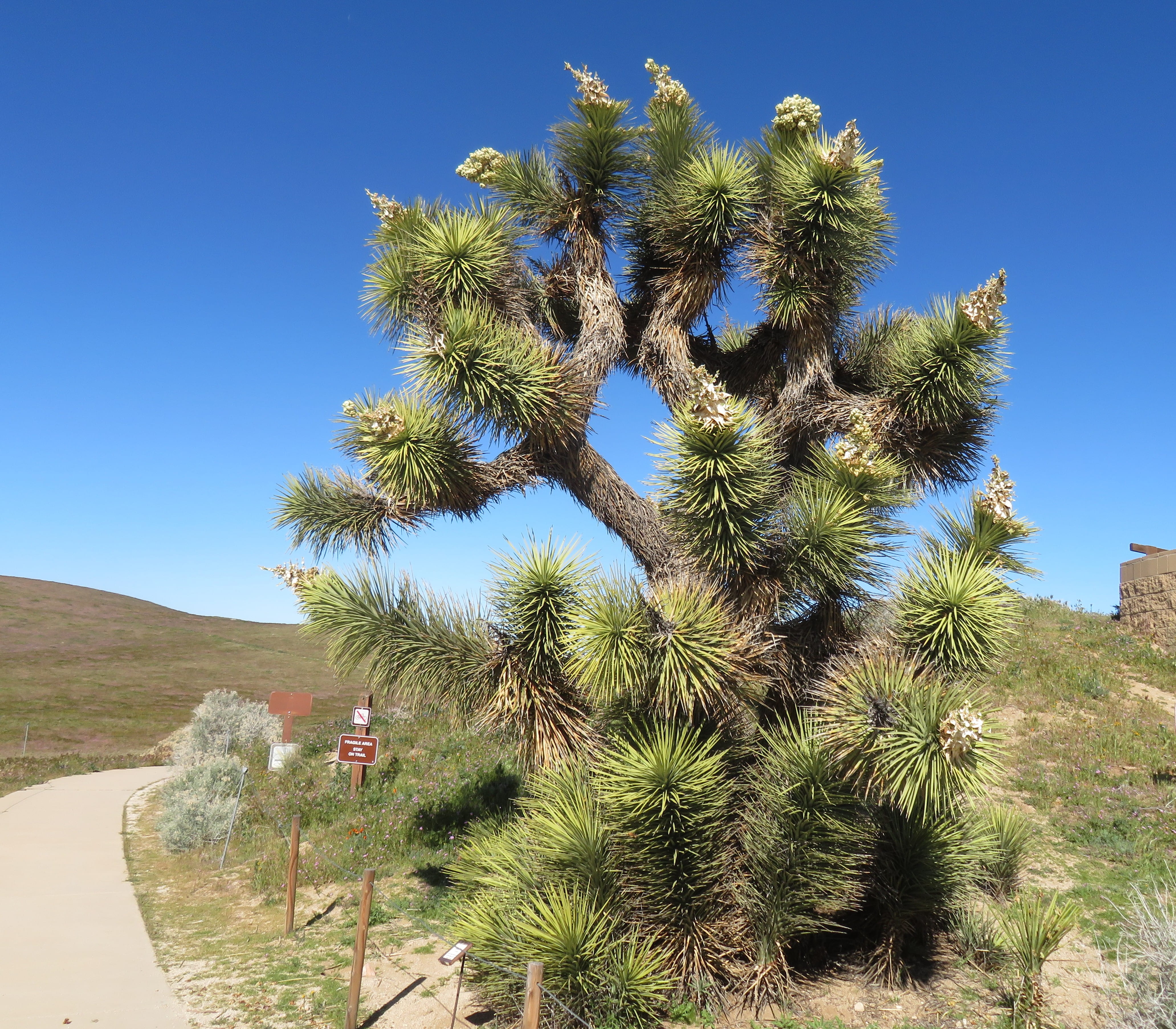
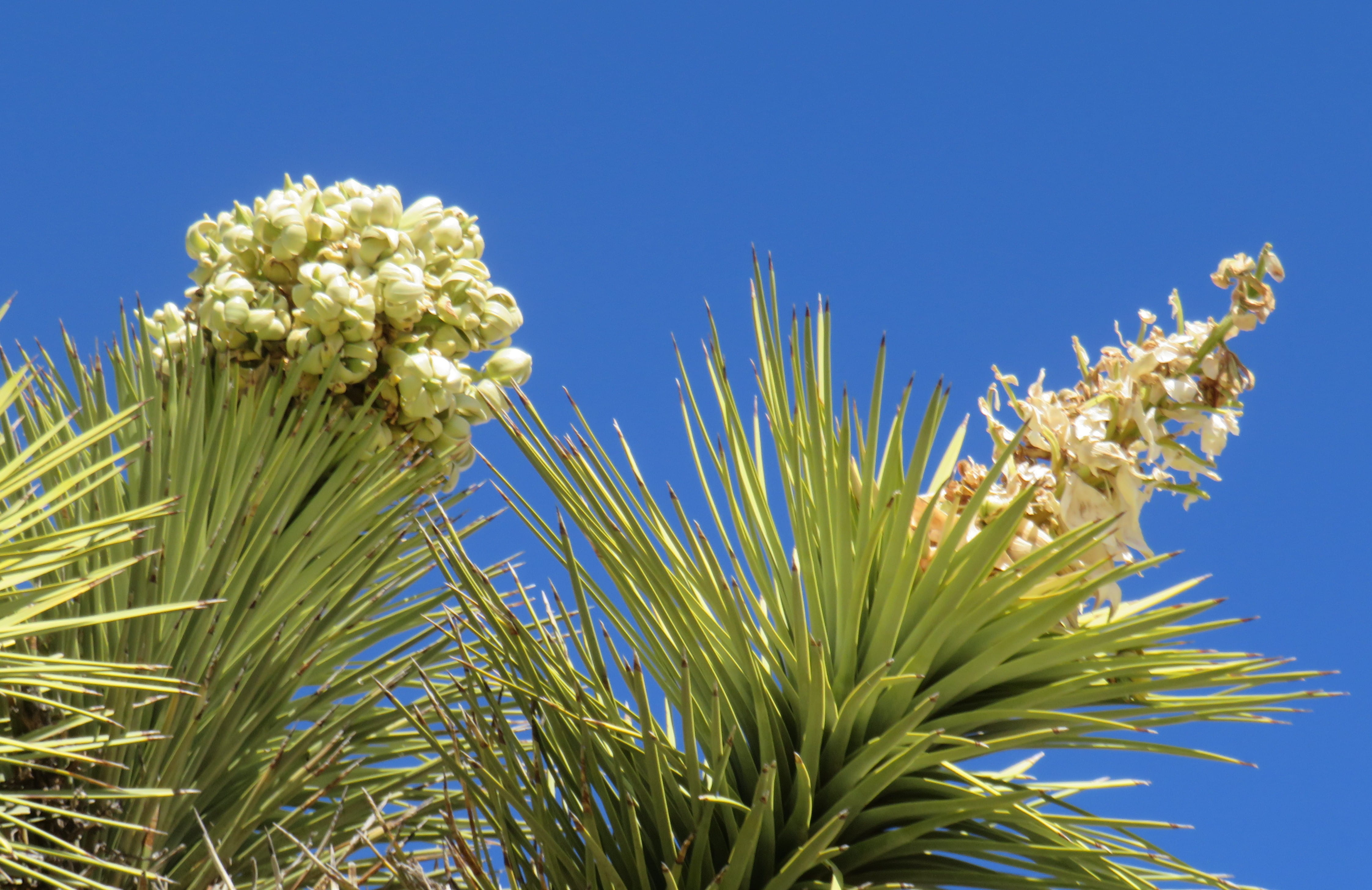
Right outside of the visitor center, there were two large Joshua Trees with white flowers and green pods. Rei and I both took several photos. This would save us a trip to Joshua Tree National Park to see the trees flowering.
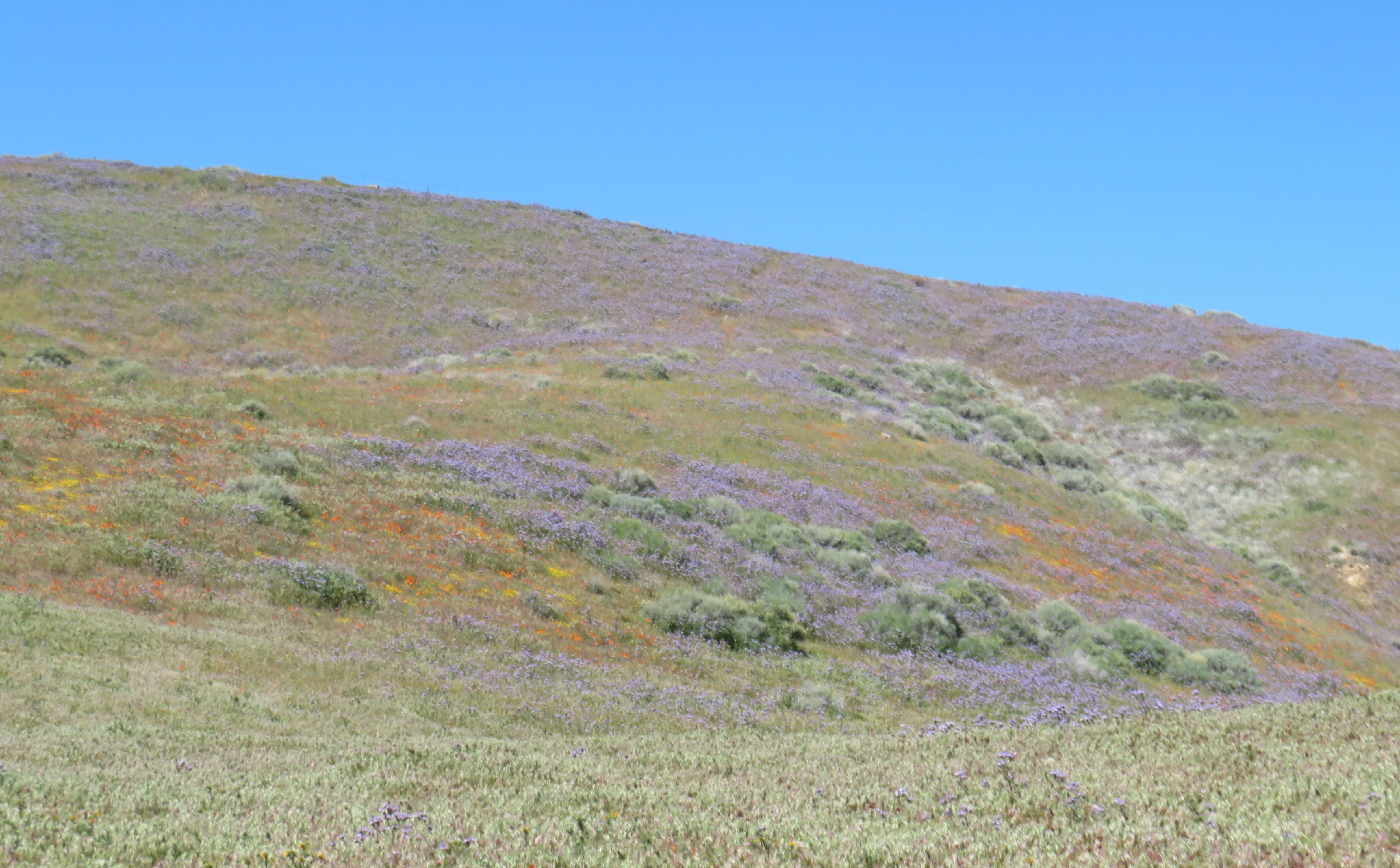
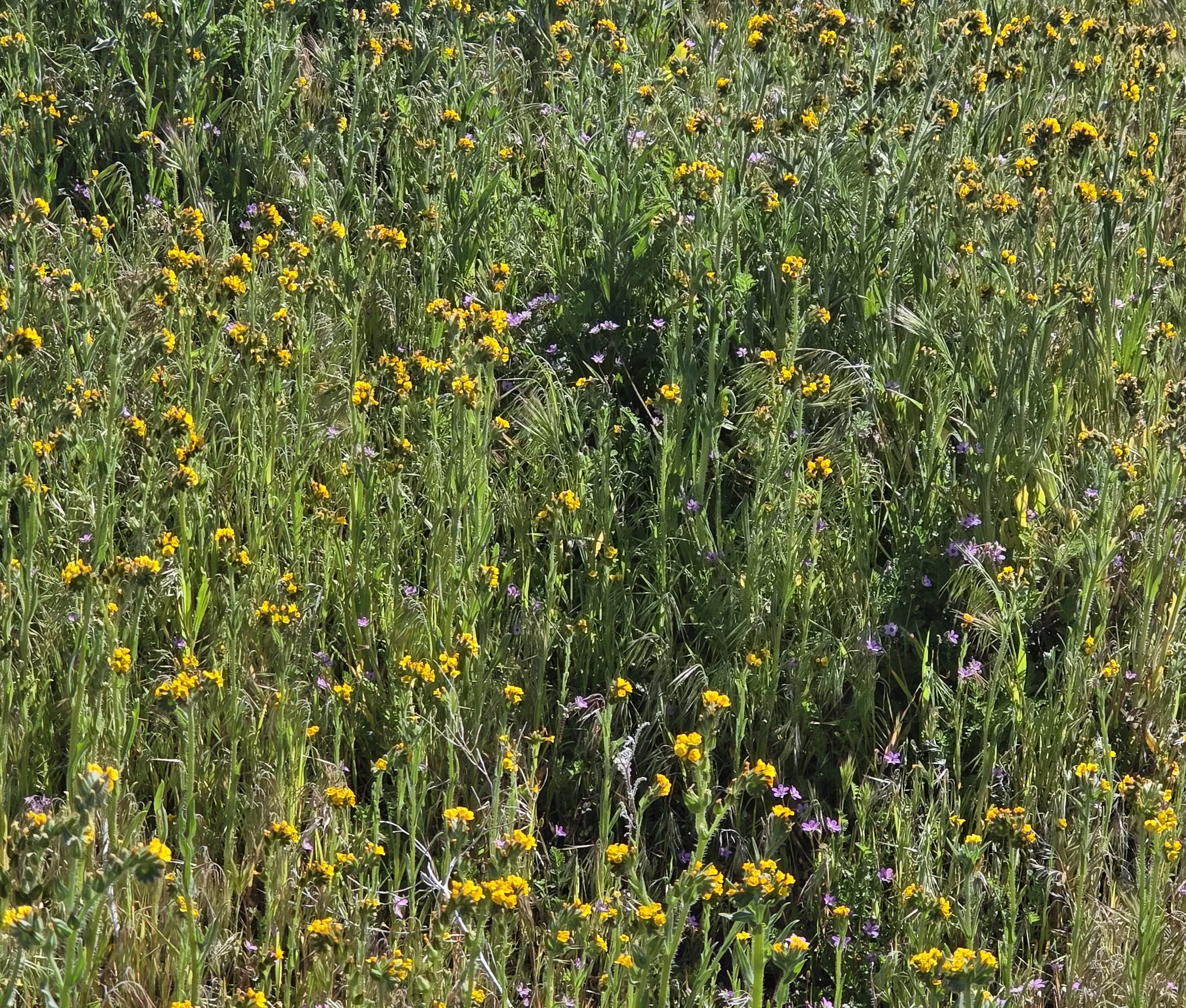
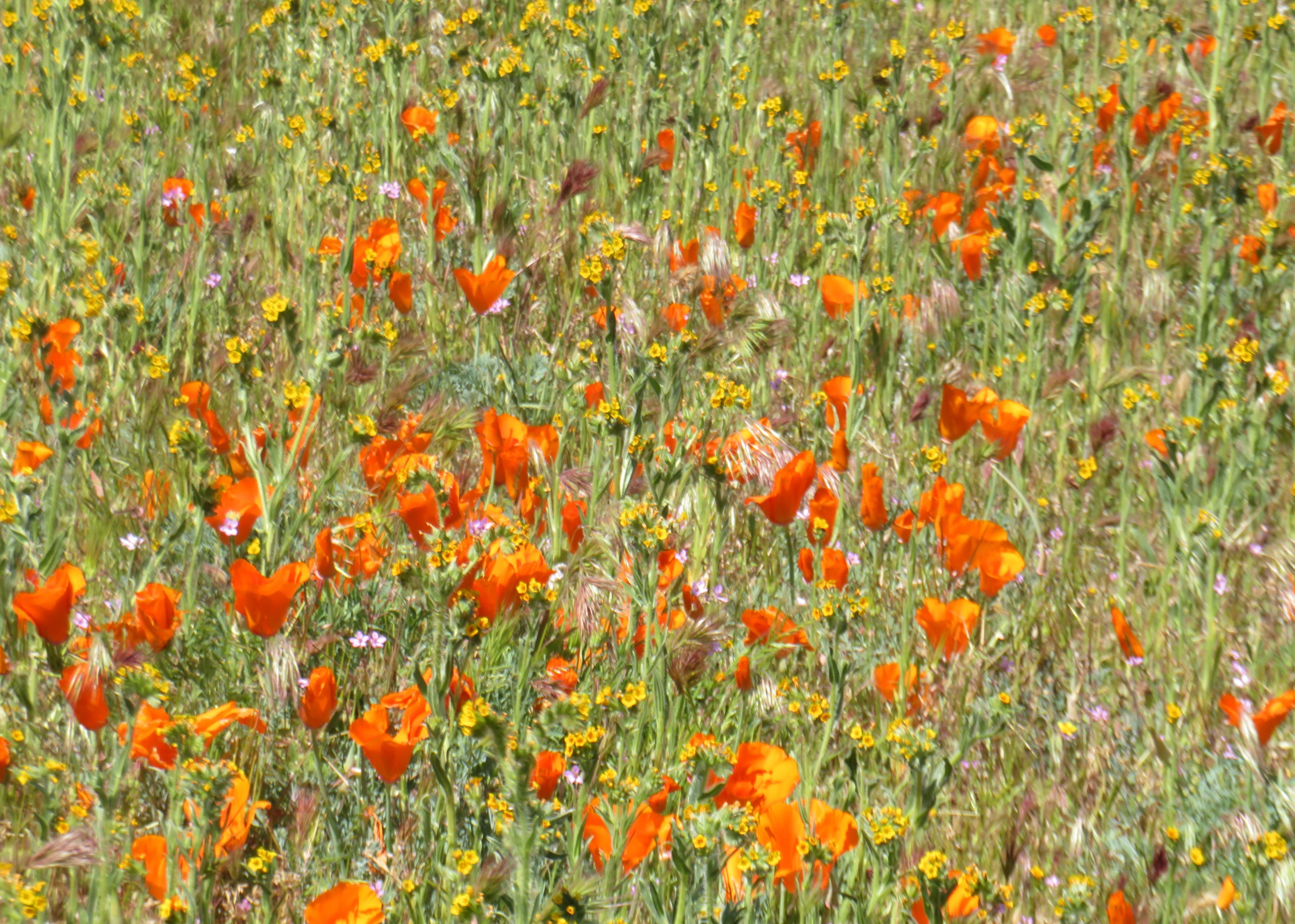
There were multiple interconnected loop trails. They were all easy hikes. Rei and I basically followed the wildflowers. Yellow Fiddleneck flowers were everywhere! We also saw many large patches of orange California Poppies. There were also Lupines, Blue Dicks, Red-stem Filaree. The hills were carpeted with multi-colored wildflowers and looked splendid.
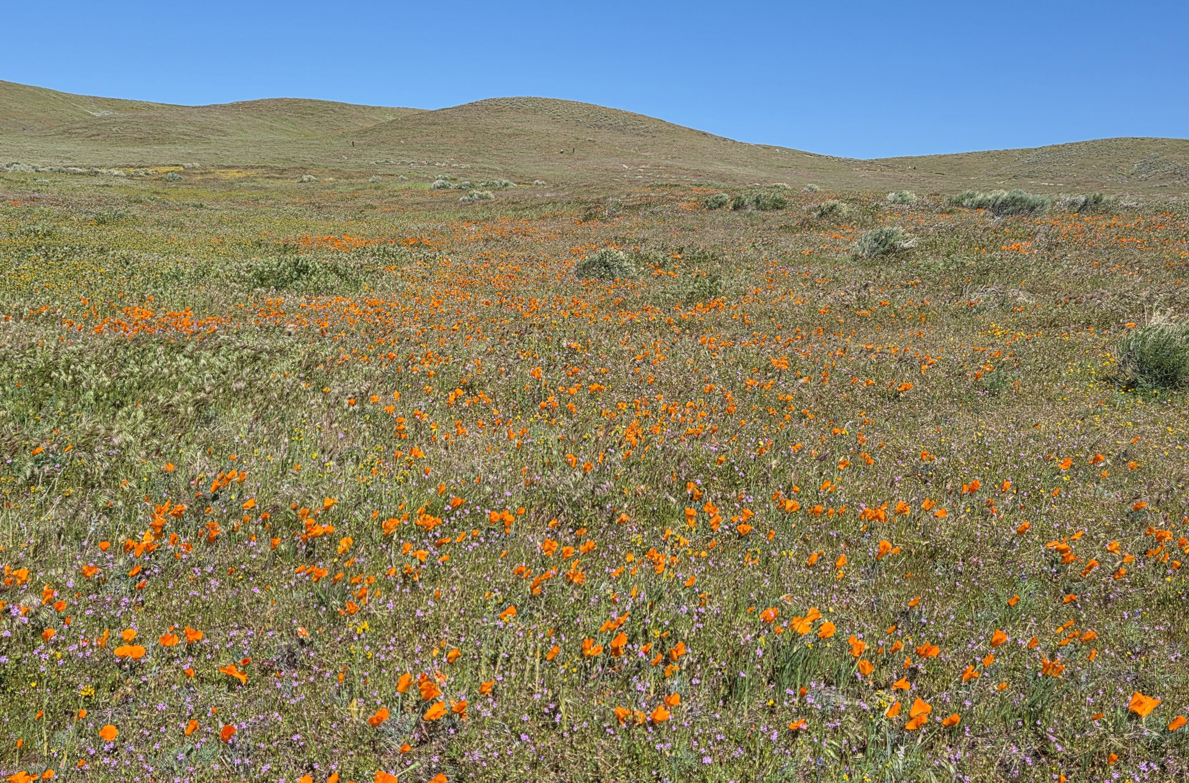
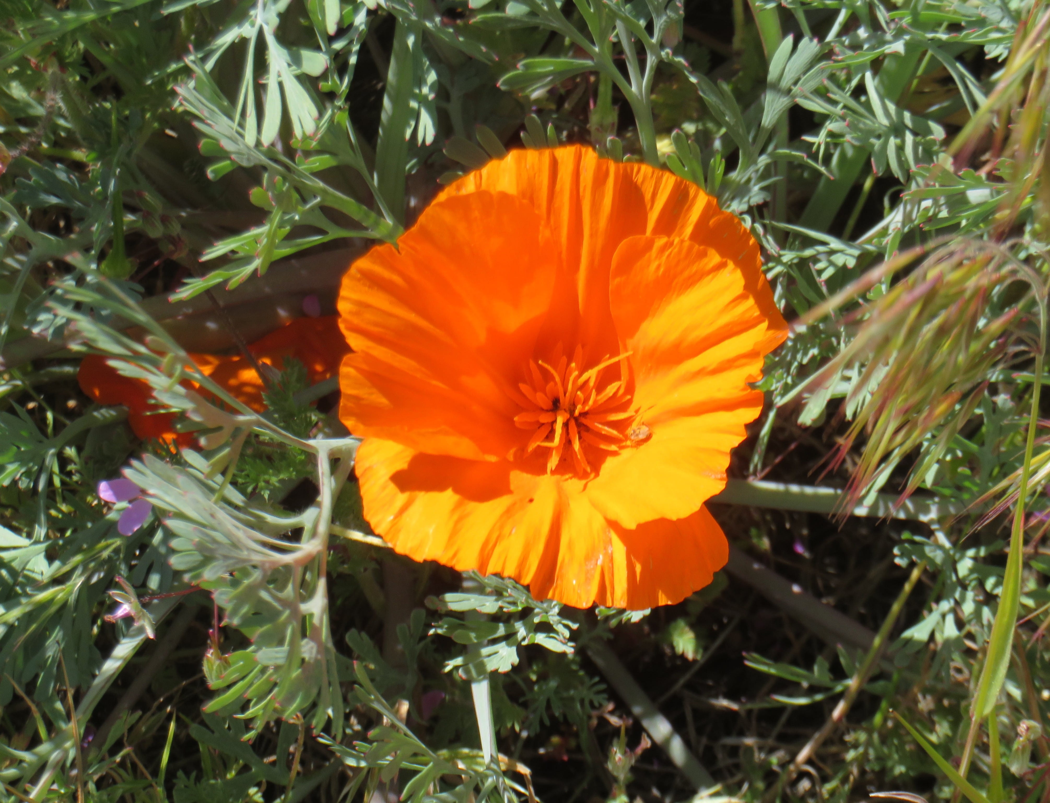
After about an hour of walking, the sun was brighter, and we saw poppies starting to open, offering better photos. We walked another half an hour before returning to the visitor center. It was still very windy outside, so we simply ate our lunch (bread and cheese) inside the car. Afterwards, it was time to drive home.
