(9/20 – 9/21/2025)
This was a short weekend trip to visit Sequoia and Kings Canyon national parks.
Day 1: Kings Canyon NP
We left home early this morning to arrive at Kings Canyon National Park before 11am. After entering the park, we first stopped by Grand Village Visitor Center to get a stamp.
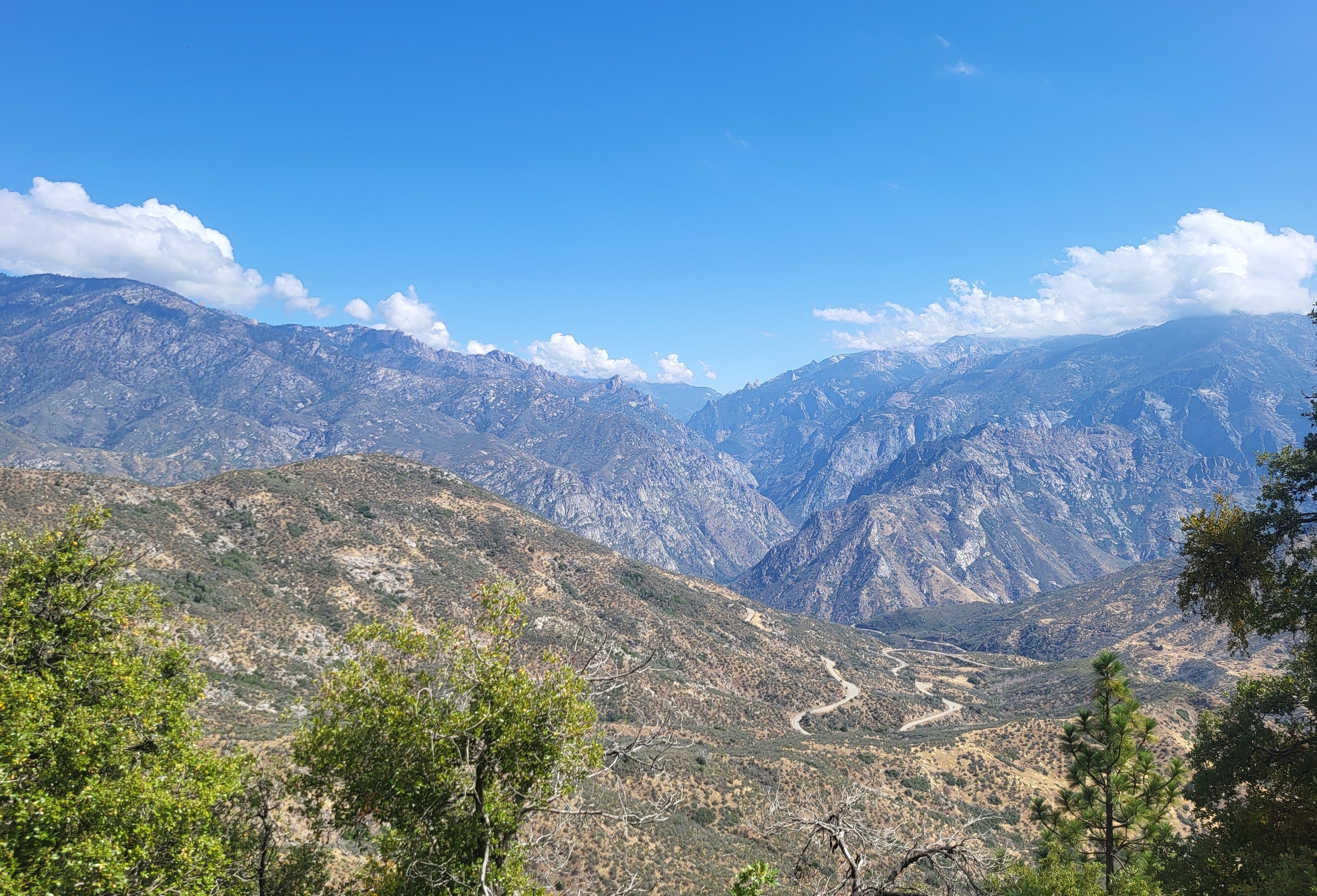
There was only one main road Hwy 180 in the park, so we drove on Hwy 180E. The configuration of the park was strange; we actually needed to pass through a large section of Sequoia National Forest.
Hwy 180E was twisty but very scenic. I saw a cavern on the map, and we decided to take a look. It turned out that we could only enter Boyden Cave by joining a guided tour that costs $17+ per person. Since we have been to many caves and we were short of time, we decided not to enter.
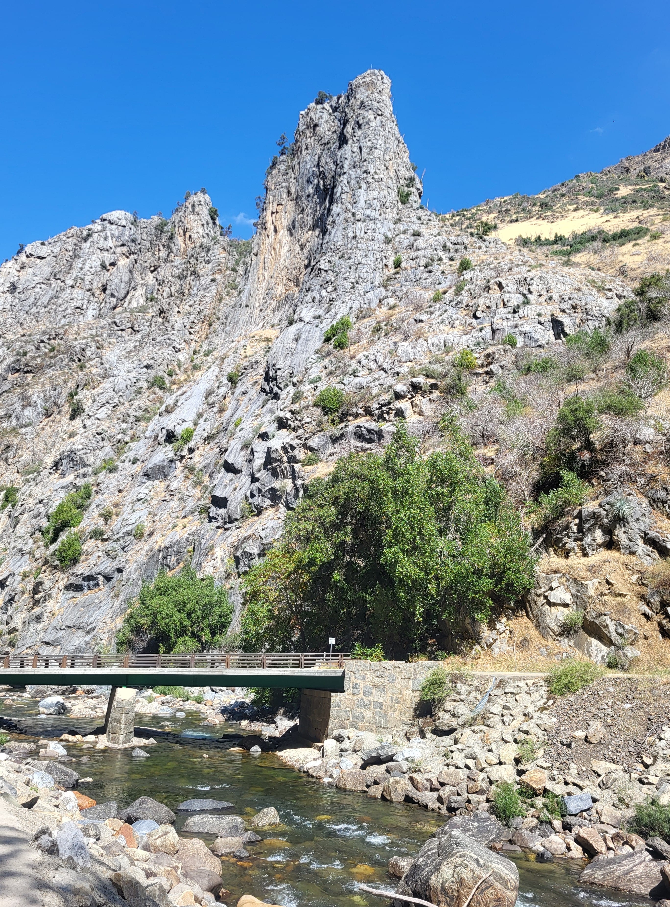
The area was by the South Fork Kings River and there were several picnic tables in the shade, so we had a lunch break here. We saw many families with young children taking the cavern tour. It must be interesting for the kids.
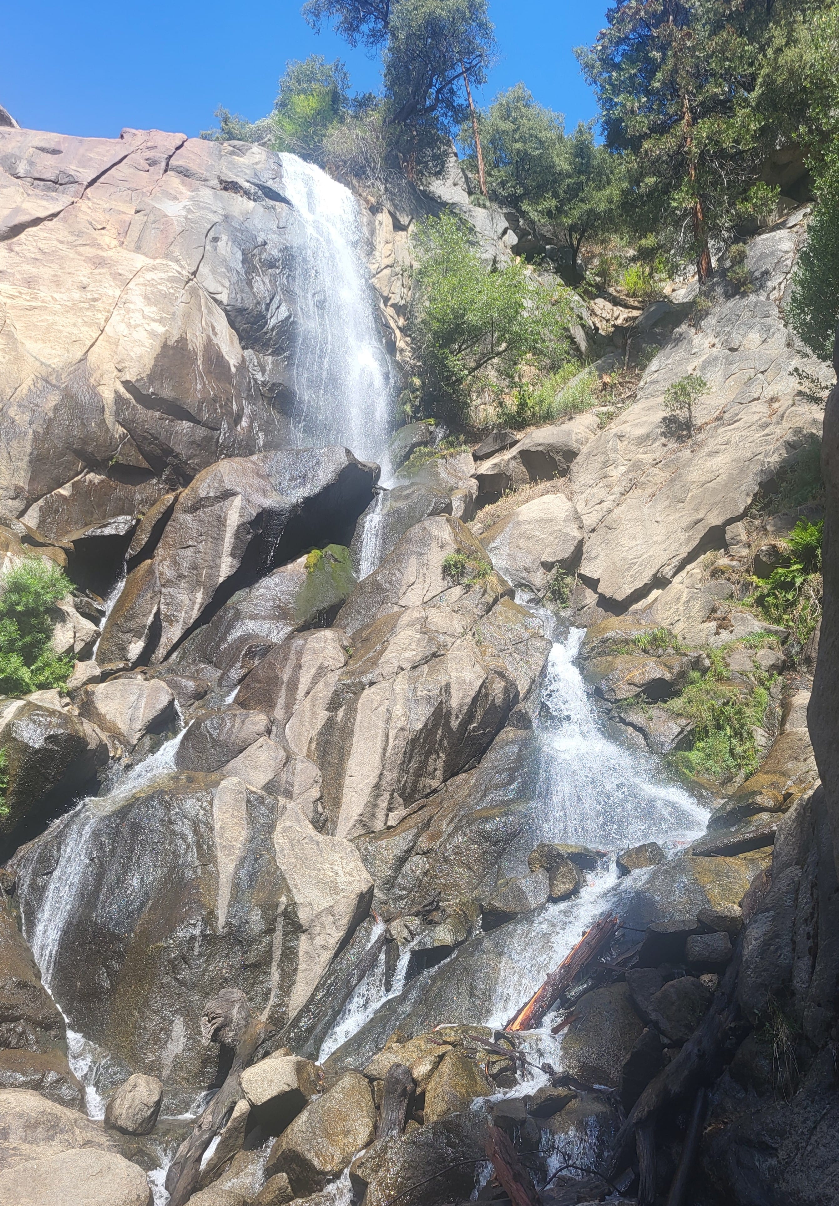
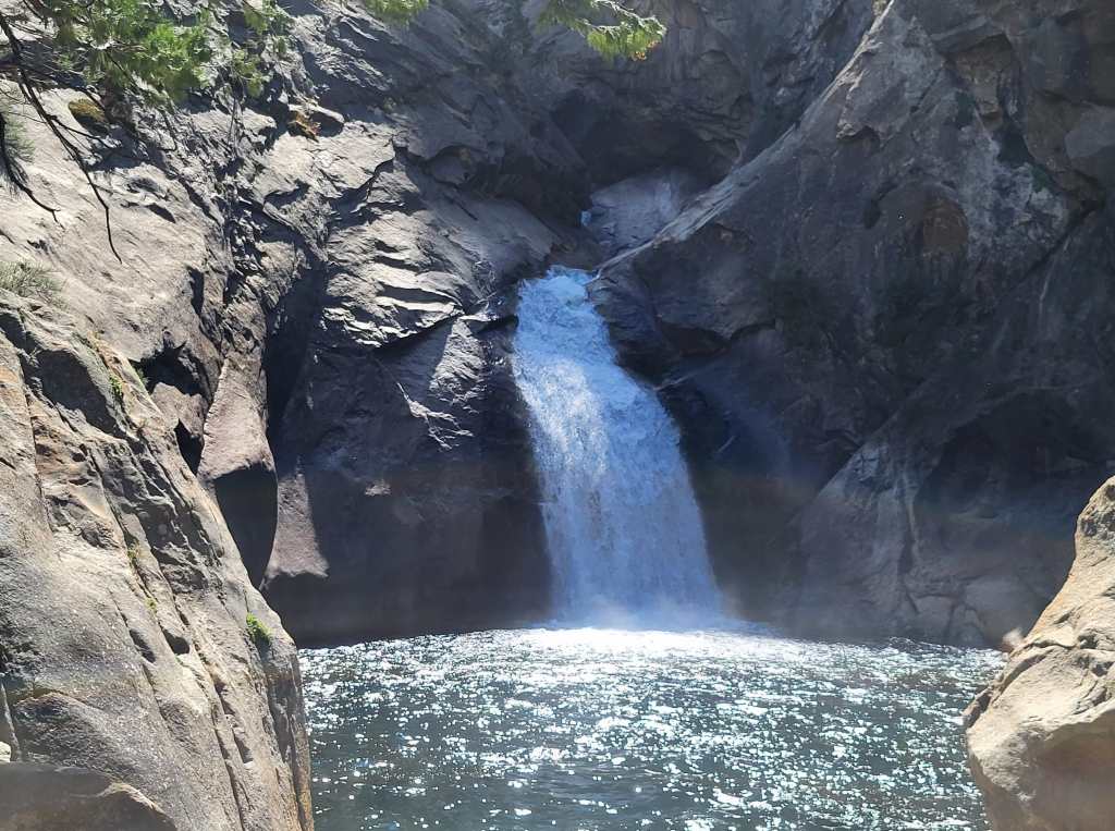
It only took us no more than 15 minutes to reach Grizzly Falls. The waterfall was visible from the parking lot and could be reached by a very short walk. Grizzly Falls was tall and elegant with abundant water. It’s beautiful!
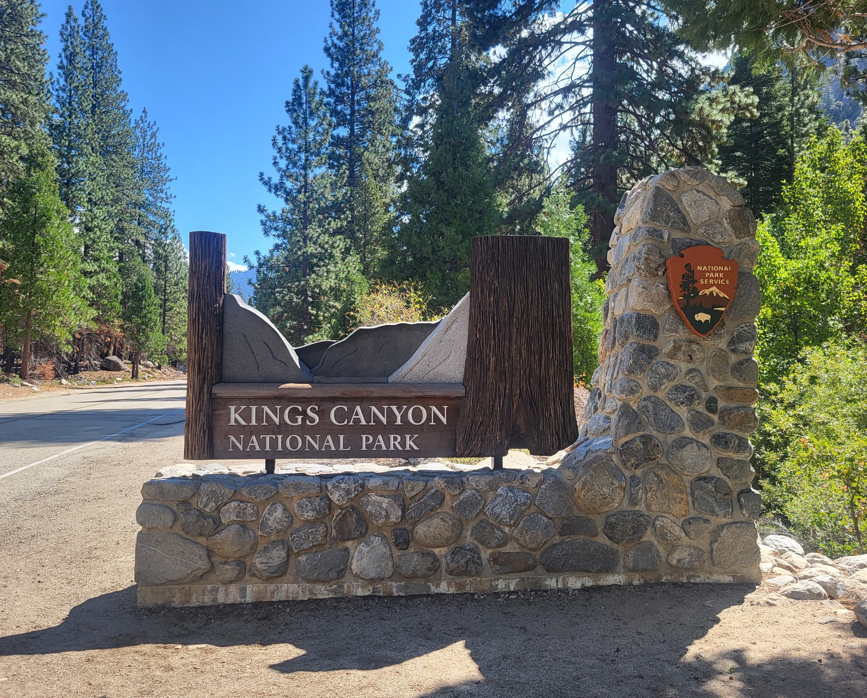
Then we entered Kings Canyon NP again and we saw the park sign, so we stopped the car to take some photos.
Roaring River Falls couldn’t be seen from the road, but a short and easy trail took us to the waterfall in less than 10 minutes. The waterfall was raging and roaring with a lot of water. However, it was a shorter waterfall and didn’t look as elegant.
I planned to hike from the waterfall to Zumwalt Meadow, but Rei suggested that we drove to Roads End and then walk to the meadow from there instead.
The parking lot at Roads End was very full, but we still managed to find a spot to park our car. It’s the same situation every place in Kings Canyon we went. It’s a popular but not over-crowded national park. However, it’s near the end of September. We were not sure whether the summer crowd would be much larger.
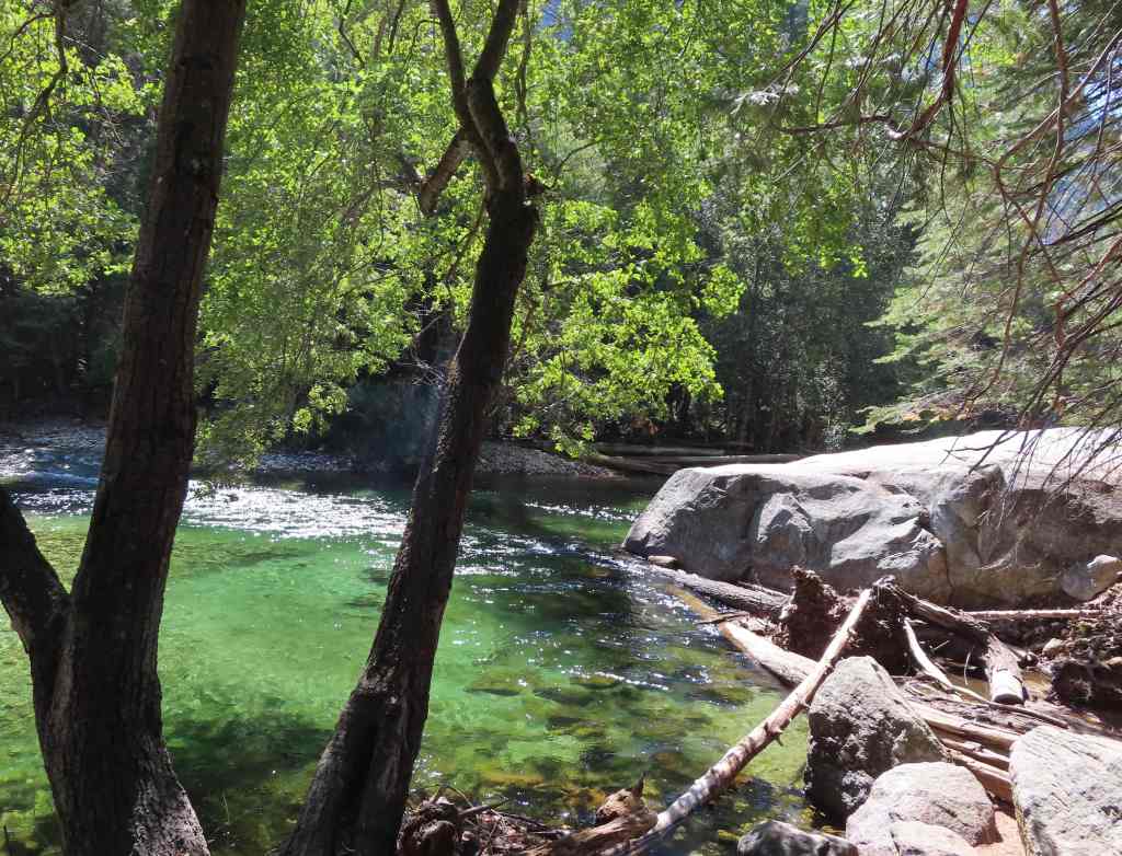
Muir Rock was a giant rock by the South Fork Kings River. The place was a great water hole. The river was calmer and not too deep here. We saw many people in the water, including some children.
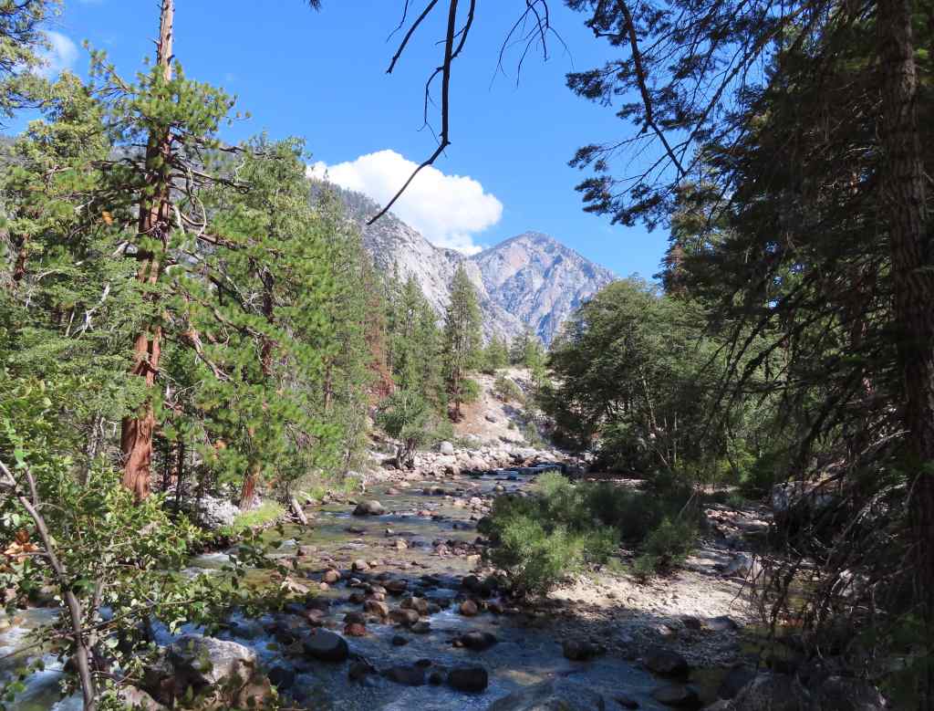
The trail here was very similar to the trails we hiked in Yosemite; even the canyon wall rock formation was very similar! The trail to Zumwalt Meadow was only 1+ miles with many interesting viewpoints. It was supposed to be a loop; however, the return trail was closed. So, we had to walk on the roadside to return to our car. We found out that the roadside had even more bugs than on the trail, and it was very annoying!
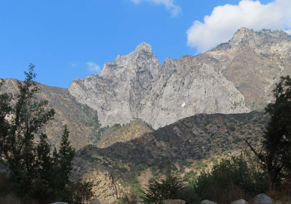
On the way back to Grand Village, I was on the canyon view side and was able to take many amazing photos from the car. We went to Grand Tree Trail. It was a popular place with many tourists, and there was even a big tour bus at the parking lot. We were surprised to find so many people because it was already 4pm!
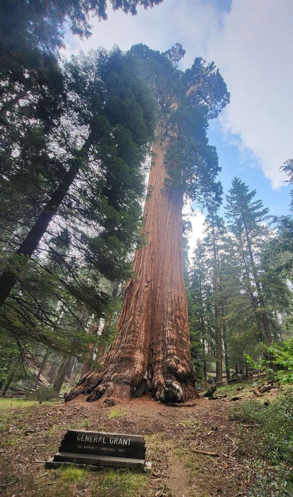
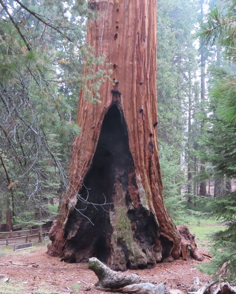
The loop trail was short. There were many sequoia trees, even a tree trunk tunnel! General Grant Tree was the main attraction here, and many people were taking photos. Even though the tree had fire scars, it was still very impressive.
We didn’t stay inside the national park, and it was a long drive to reach our hotel. When we checked in, it was already close to 7pm. Therefore, we went to dinner first before taking a shower.
Day 2: Sequoia NP
We checked out around 8am. Sequoia NP was about an hour’s drive away. We saw many motels close to the park entrance, and Rei suggested that perhaps we could stay there in the future. When we arrived, there were many cars waiting to enter the national park. It seemed that Sequoia NP was more popular than Kings Canyon NP.
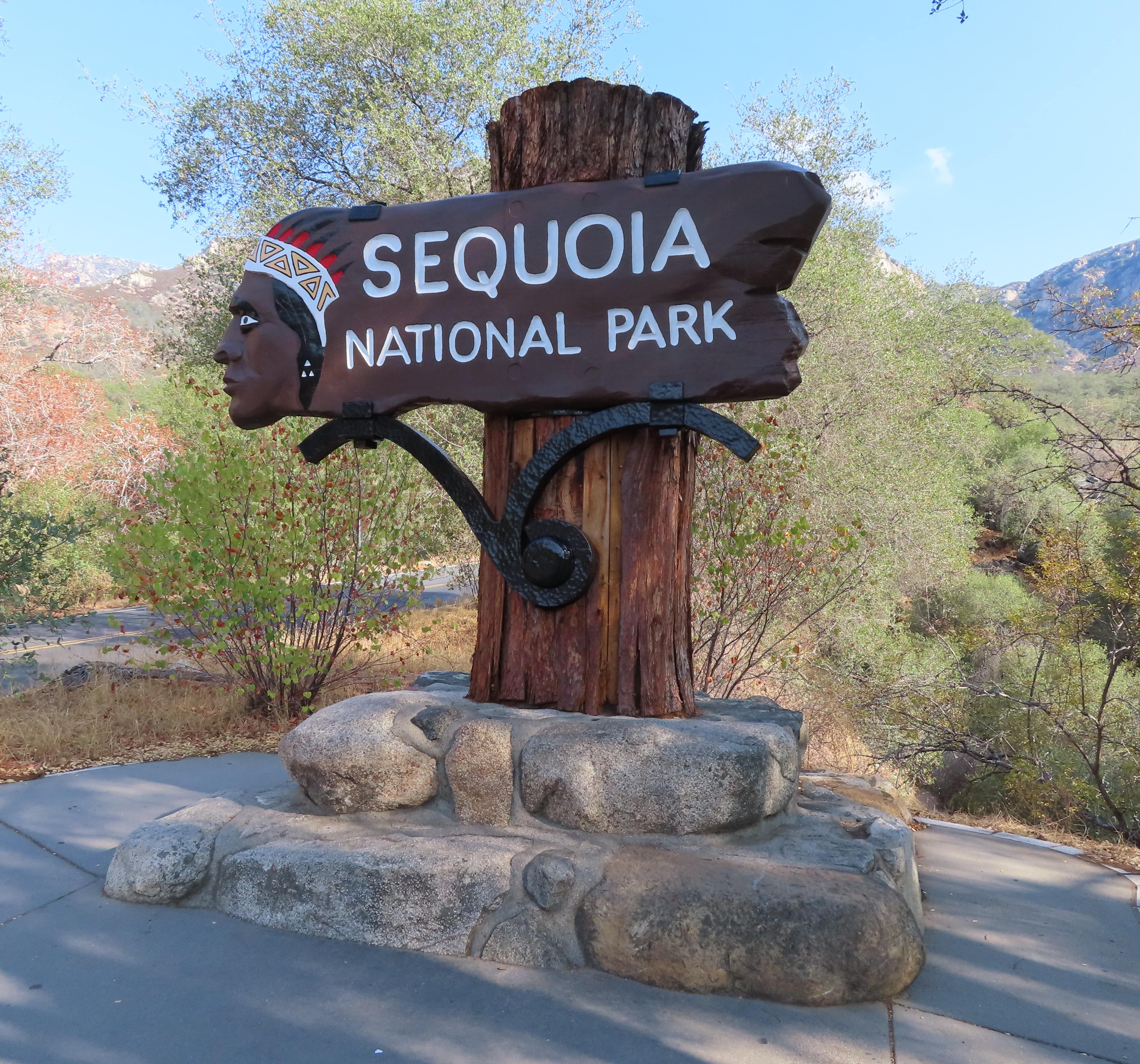
The park sign was shortly after the entrance station, where we took some photos before reaching Foothills Visitor Center. In the visitor center, we got our first Sequoia NP stamp.
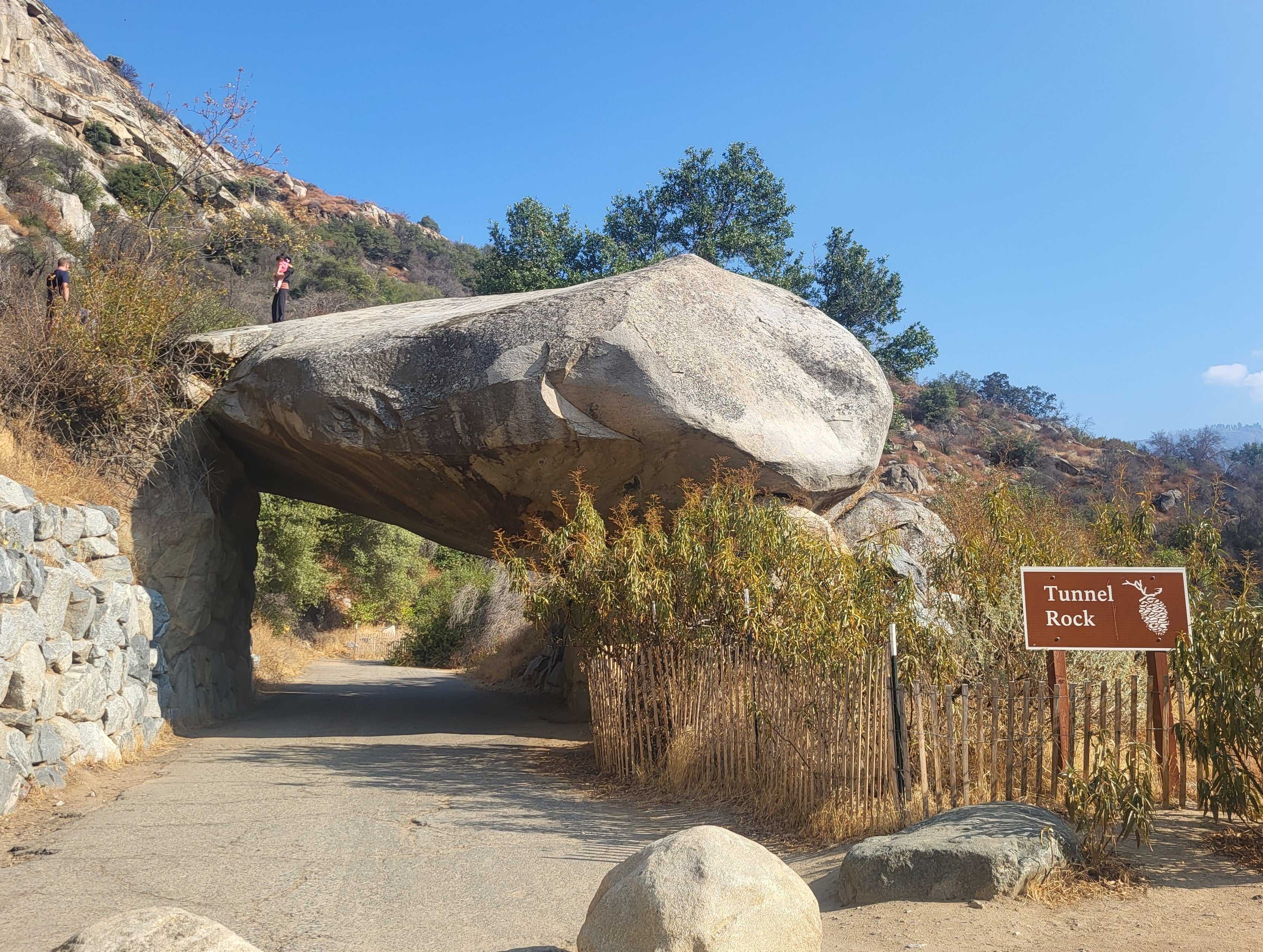
Tunnel Rock was only about 1 mile from the visitor center. There was a young ranger onsite to provide information about the rock. She told us that cars used to enter the park through Tunnel Rock. The opening wasn’t large; some cars squeezed by and left scratch marks on the inside of the tunnel! Eventually there was too much traffic, and a road was built for cars to bypass the tunnel.
It’s possible to climb on top of Tunnel Rock. Though there was a warning sign, many visitors climbed up to pose for photos. Rei and I took turns climbing, so that the other person could stay below to take photos.
Since we would only have about 5 hours to spend inside the park, we had to skip some sites. Moreover, several places were only open during summer months anyway.
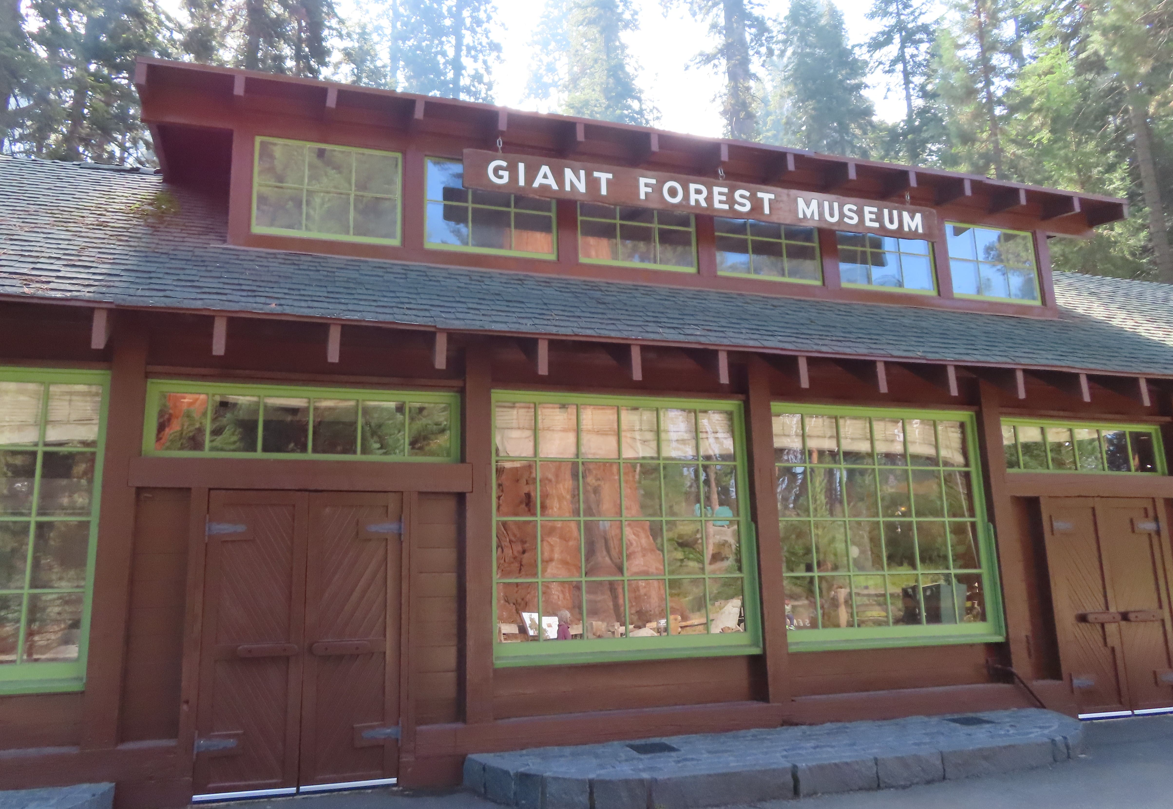
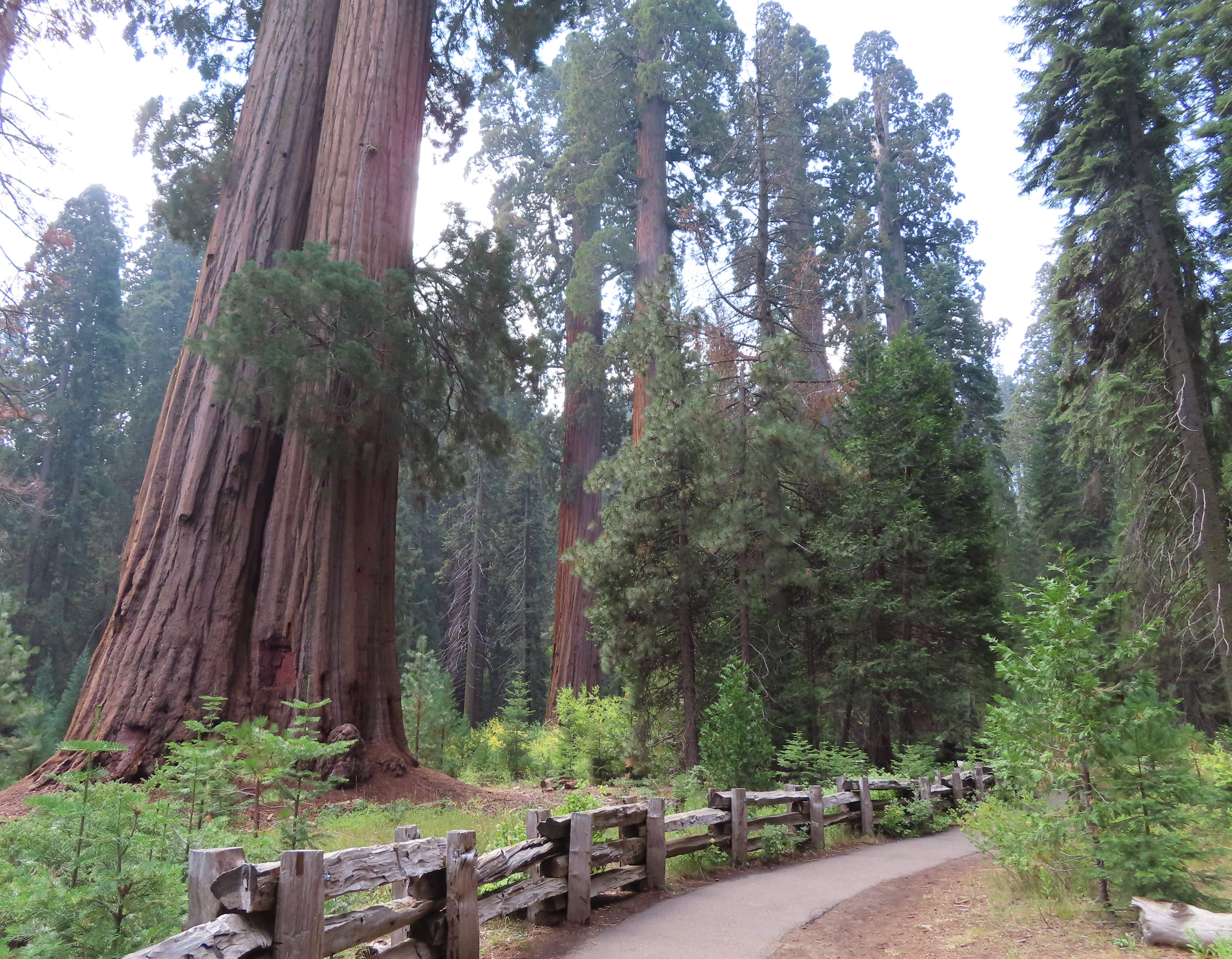
Our next stop was the Giant Forest Museum. There’s a giant Sentinel sequoia tree standing outside the museum. The museum itself wasn’t too interesting though it provided a lot of information for curious minds. There’s a stamping station inside the museum with an extra “sequoia leaves and cone” stamp. The Big Tree Trail loop was only 1.2 miles, but there were many places to take photos, so we spent about an hour on the trail.
The road inside the park was very twisty, especially between the entrance and the museum. It was much better after the museum.
There were a lot of cars at the Sherman Tree parking lot. The trail was also very crowded. It was only 1.2 miles to walk to General Sherman Tree and back, but there was a drop of 400+ ft. Some people were struggling with the down and up climb. It’s not a problem for Rei and me.
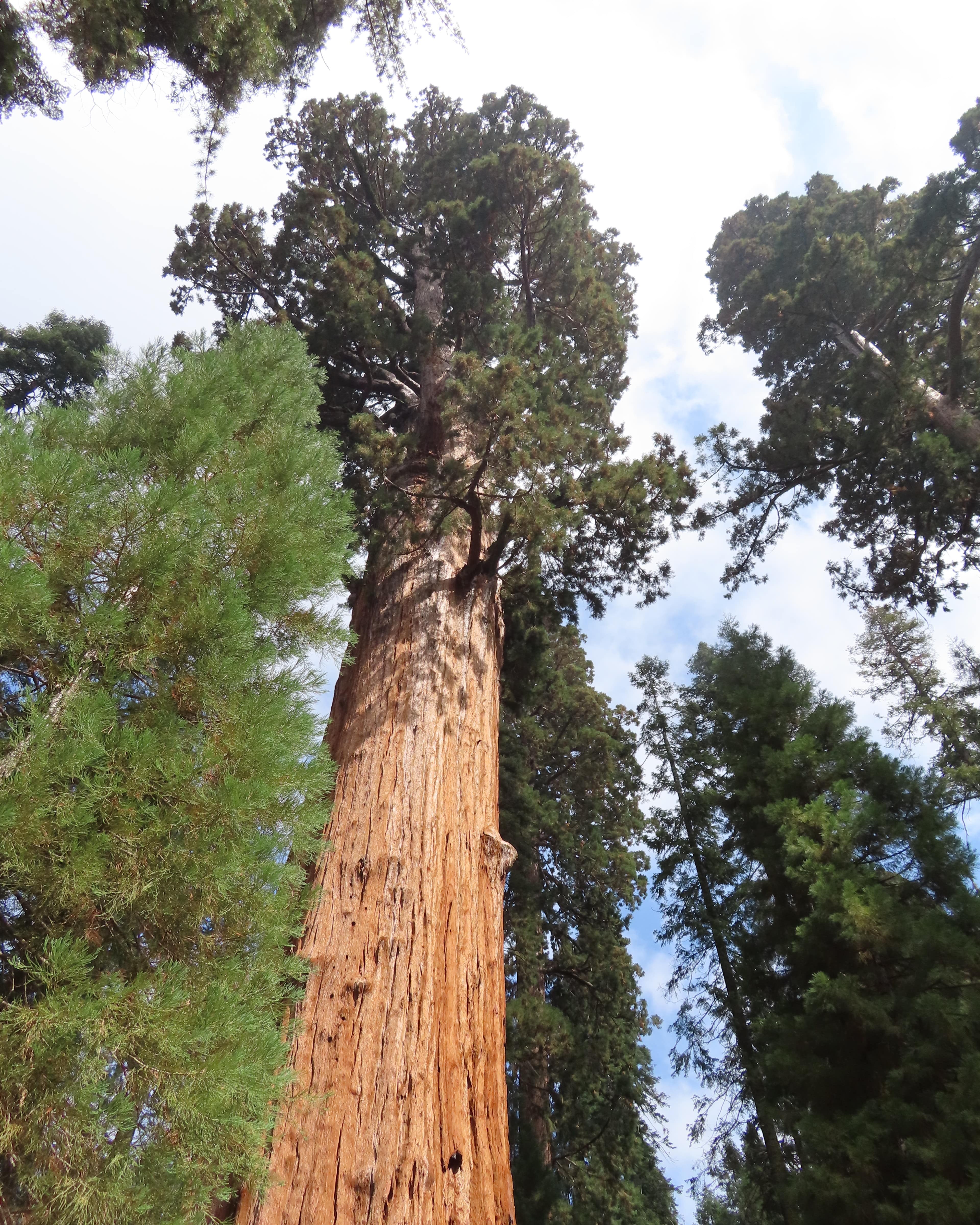
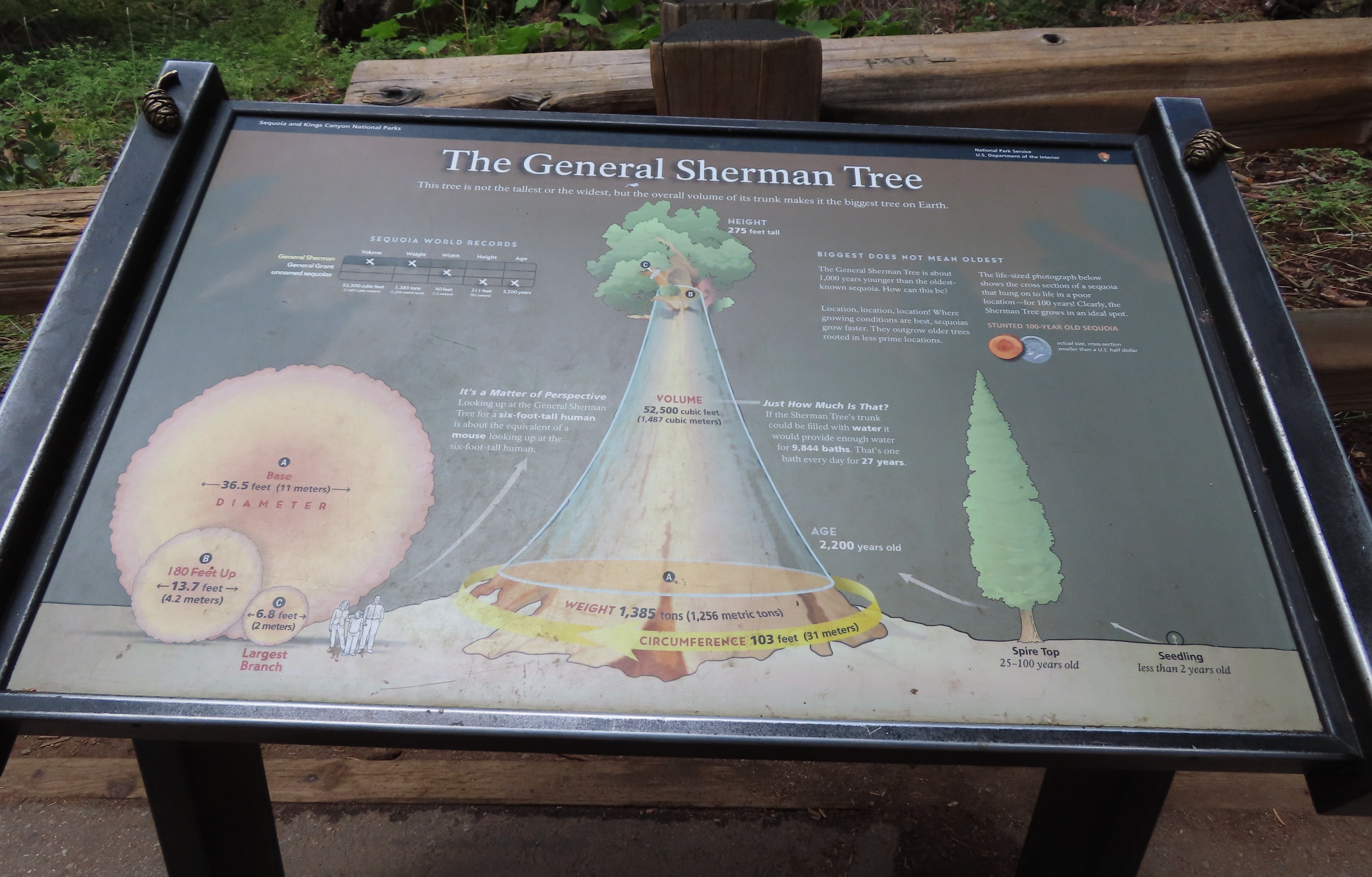
General Sherman Tree was famous for having the largest volume. There was an information board by the tree. When we reached General Sherman Tree, there was a line of 20+ people to take pictures in front of the giant sequoia. Moreover, people were taking group pictures in addition to individual photos. Rei and I didn’t feel like waiting, so we only took photos from the side. Moreover, there was no sign in front of the sequoia tree, and it didn’t make a lot of difference whether the photos were taken in which directions, since a tree didn’t have a “front” view!
It was past noon, so we drove to Lodgepole Village to have lunch and to get another stamp at the visitor center. It was another 45 minutes or so to drive from the village to the park exit at the north. We left the national park around 2pm as planned to drive home.
